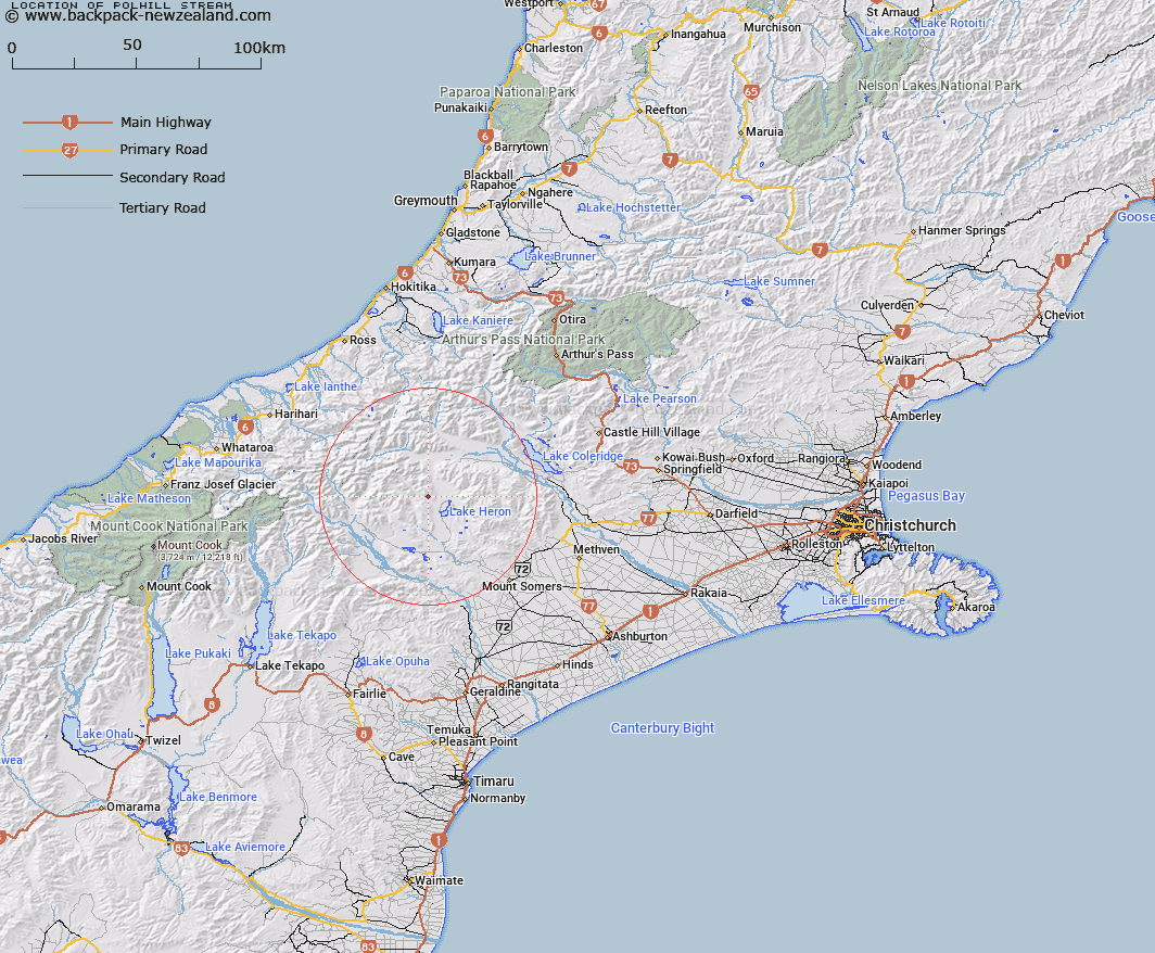
Map showing location of Polhill Stream


LINZ description: Left bank tributary of Cameron River rising 1km South-west of Middle Hill, flowing southward and joining Cameron River 3.1km North-west of Trig. N (Geodetic Code AA8G). Blocks III, and VII, Heron Survey District
Latitude: -43.426103
Longitude: 171.11442
Northing: 5190138.7
Easting: 1447374.2
Land District: Canterbury
Feat Type: Stream


Scroll down to see a more detailed road map and below that a topographical map showing the location of Polhill Stream. The road map has been supplied by openstreetmap and the topographical map of Polhill Stream has been supplied by Land Information New Zealand (LINZ).

Yes you can use the top static map for you school/university project or personal website with a link back. Contact me for any commercial use.

Polhill Stream Map New Zealand


New Zealand places in our database
[ A ] [ B ] [ C ] [ D ] [ E ] [ F ] [ G ] [ H ] [ I ] [ J ] [ K ] [ L ] [ M ] [ N ] [ O ] [ P ] [ Q ] [ R ] [ S ] [ T ] [ U ] [ V ] [ W ] [ X ] [ Y ] [ Z ]


Closest 20 Streams to Polhill Stream

Lawsley Stream ( 2.85km )   Strone Stream ( 4.02km )   Cameron River ( 4.57km )   Triangle Stream ( 5.18km )   Dunbar Stream ( 5.37km )   Lochiel Stream ( 5.55km )   Lake Stream ( 6.28km )   Olliver Stream ( 7.02km )   Charlie Stream ( 7.72km )   Bush Creek ( 8km )   Nell Stream ( 8.23km )   Lochaber Stream ( 8.41km )   Ribbonwood Stream ( 8.6km )   Red Moutain Stream ( 8.64km )   Stumpy Stream ( 8.68km )   Spean Stream ( 8.83km )   Leach Stream ( 9.18km )   Swin River ( 9.64km )   Home Creek ( 9.95km )   Smite River ( 10.1km )   Mellish Stream ( 10.88km )   Sparrow Hawk Stream ( 11.44km )   Washbourne Creek ( 11.75km )   Harding Stream ( 11.81km )   Clent Hills Stream ( 11.85km )   Godley Stream ( 12.16km )   Swin River North Branch ( 13.01km )   Swin River South Branch ( 13.28km )   Potts River ( 14.23km )   Shingly Creek ( 14.28km )   Johnstone Stream ( 14.41km )   Jagged Stream ( 14.47km )   Maxwell Stream ( 14.59km )   Gentleman Smith Stream ( 15.13km )   Glenfalloch Stream ( 15.2km )   Round Hill Creek ( 15.34km )   Finger Stream ( 15.63km )   Emily Stream ( 15.7km )   Jacobs Stream ( 15.81km )   Logan Stream ( 16.09km )