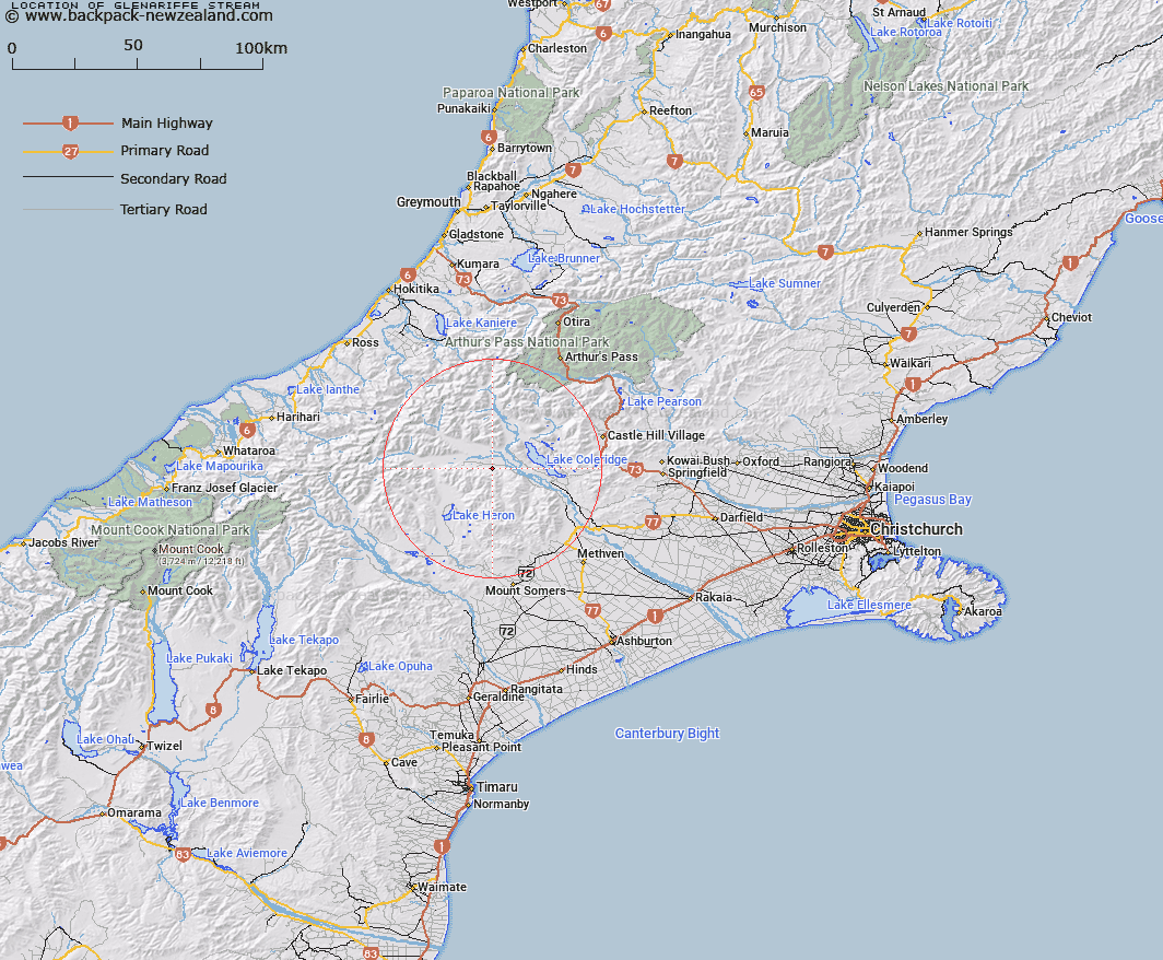
Map showing location of Glenariffe Stream


LINZ description: Stream flowing through Glenariffe Run near homestead and enters Rakaia River on South Bank approximately I mile west of Glenrock Stream
Latitude: -43.316754
Longitude: 171.327132
Northing: 5202650.5
Easting: 1464348.6
Land District: Canterbury
Feat Type: Stream


Scroll down to see a more detailed road map and below that a topographical map showing the location of Glenariffe Stream. The road map has been supplied by openstreetmap and the topographical map of Glenariffe Stream has been supplied by Land Information New Zealand (LINZ).

Yes you can use the top static map for you school/university project or personal website with a link back. Contact me for any commercial use.

Glenariffe Stream Map New Zealand


New Zealand places in our database
[ A ] [ B ] [ C ] [ D ] [ E ] [ F ] [ G ] [ H ] [ I ] [ J ] [ K ] [ L ] [ M ] [ N ] [ O ] [ P ] [ Q ] [ R ] [ S ] [ T ] [ U ] [ V ] [ W ] [ X ] [ Y ] [ Z ]


Closest 20 Streams to Glenariffe Stream

Double Hill Stream ( 1.46km )   Colonel Stream ( 1.74km )   Gerard Stream ( 2.94km )   Glenrock Stream ( 4.14km )   Station Creek ( 5.16km )   Titan Stream ( 6.29km )   Petticoat Lane ( 7.28km )   Ensor Stream ( 7.51km )   Donald Stream ( 8.44km )   Glenfalloch Stream ( 8.72km )   Gorgon Stream ( 9.26km )   Turtons Stream ( 9.5km )   Shingly Creek ( 9.65km )   Comyns Stream ( 9.67km )   Godley Stream ( 10.53km )   Cardinal Stream ( 10.78km )   Big Fan Creek ( 12.26km )   Chimera Stream ( 12.55km )   Smite River ( 12.64km )   Boulderstone Stream ( 12.72km )   Ribbonwood Stream ( 12.77km )   Nell Stream ( 12.84km )   Round Hill Creek ( 13km )   Barnard Stream ( 13.22km )   Lake Stream ( 13.41km )   Broad Creek ( 13.45km )   Charlie Stream ( 13.59km )   Leach Stream ( 13.62km )   Oakden Canal ( 13.76km )   Packers Creek ( 13.81km )   McCracken Stream ( 14.12km )   Logan Stream ( 14.2km )   Big Paddock Creek ( 14.3km )   Kakapo Stream ( 14.47km )   Wilberforce Canal ( 14.59km )   Harper River Diversion ( 14.91km )   Twin Creek ( 15.4km )   Redcliffe Stream ( 15.53km )   Mathias River ( 15.53km )   Lake Stream ( 15.85km )