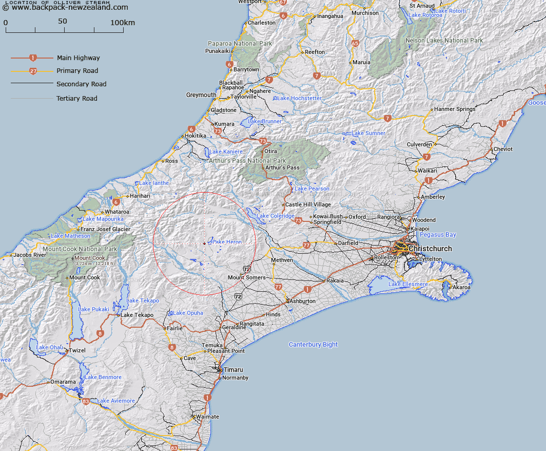
Map showing location of Olliver Stream


LINZ description: Tributary of Lake Heron rising 2.3km South of Pyramid Peak [Trig. V (Geodetic Code AN5Q)], flowing generally eastward and entering Lake Heron near Mount Arrowsmith Homestead. Blocks VI, X and XI Heron Survey District.
Latitude: -43.488525
Longitude: 171.12779
Northing: 5183230.5
Easting: 1448612.3
Land District: Canterbury
Feat Type: Stream


Scroll down to see a more detailed road map and below that a topographical map showing the location of Olliver Stream. The road map has been supplied by openstreetmap and the topographical map of Olliver Stream has been supplied by Land Information New Zealand (LINZ).

Yes you can use the top static map for you school/university project or personal website with a link back. Contact me for any commercial use.

Olliver Stream Map New Zealand


New Zealand places in our database
[ A ] [ B ] [ C ] [ D ] [ E ] [ F ] [ G ] [ H ] [ I ] [ J ] [ K ] [ L ] [ M ] [ N ] [ O ] [ P ] [ Q ] [ R ] [ S ] [ T ] [ U ] [ V ] [ W ] [ X ] [ Y ] [ Z ]


Closest 20 Streams to Olliver Stream

Olliver Stream ( 0km )   Triangle Stream ( 2.19km )   Dunbar Stream ( 3.02km )   Harding Stream ( 5.09km )   Clent Hills Stream ( 5.29km )   Red Moutain Stream ( 5.33km )   Swin River ( 5.98km )   Sparrow Hawk Stream ( 6.55km )   Polhill Stream ( 7.02km )   Johnstone Stream ( 7.61km )   Mellish Stream ( 8.08km )   Gentleman Smith Stream ( 8.35km )   Lawsley Stream ( 8.95km )   Jacobs Stream ( 9.22km )   Emily Stream ( 9.23km )   Swin River South Branch ( 9.65km )   Home Creek ( 9.87km )   Swin River North Branch ( 9.94km )   Strone Stream ( 10.12km )   Paddle Hill Creek ( 10.28km )   Cameron River ( 10.39km )   Finger Stream ( 11.23km )   Stumpy Stream ( 11.5km )   Haast Stream ( 11.51km )   Lochiel Stream ( 11.63km )   Kenneth Creek ( 11.83km )   Maxwell Stream ( 12.02km )   Ribbonwood Stream ( 12.39km )   Smite River ( 12.44km )   Craddock Stream ( 12.45km )   Cradock Stream ( 12.45km )   Lake Stream ( 12.7km )   Stour River West Branch ( 12.93km )   Nell Stream ( 13.14km )   Charlie Stream ( 13.25km )   Potato Stream ( 13.55km )   Stour River East Branch ( 14.21km )   Black Stream ( 14.28km )   Markhams Stream ( 14.47km )   Spean Stream ( 14.51km )