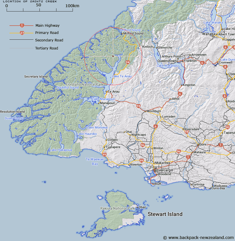
Map showing location of Saints Creek


LINZ description: Stream flowing into Worsley Stream, approximately 1/2 mile from its entrance to Lake Te Anau. Clinton Survey District.
Latitude: -44.95829
Longitude: 167.803558
Northing: 5008532.1
Easting: 1190142.8
Land District: Southland
Feat Type: Stream


Scroll down to see a more detailed road map and below that a topographical map showing the location of Saints Creek. The road map has been supplied by openstreetmap and the topographical map of Saints Creek has been supplied by Land Information New Zealand (LINZ).

Yes you can use the top static map for you school/university project or personal website with a link back. Contact me for any commercial use.

Saints Creek Map New Zealand


New Zealand places in our database
[ A ] [ B ] [ C ] [ D ] [ E ] [ F ] [ G ] [ H ] [ I ] [ J ] [ K ] [ L ] [ M ] [ N ] [ O ] [ P ] [ Q ] [ R ] [ S ] [ T ] [ U ] [ V ] [ W ] [ X ] [ Y ] [ Z ]


Closest 20 Streams to Saints Creek

McQueen Creek ( 4.4km )   Billy Burn ( 5.47km )   Narrows Creek ( 6.06km )   Castle River ( 6.09km )   Indecision Creek ( 6.97km )   Newton Creek ( 7.04km )   Nitz Creek ( 7.4km )   Terminus Creek ( 8.45km )   Glaisnock River ( 9.58km )   Worsley Stream ( 9.61km )   Kakapo Creek ( 9.91km )   Clinton River ( 10.32km )   Prospect Creek ( 10.62km )   Nurse Creek ( 10.66km )   Henderson Burn ( 11.64km )   Clinton River West Branch ( 11.78km )   Taheke Creek ( 12.4km )   Glade Burn ( 12.76km )   Inaccessible Creek ( 13.21km )   Lugar Burn ( 14.26km )   Clinton River North Branch ( 14.34km )   Murcott Burn ( 14.42km )   Starvation Creek ( 14.67km )   Epidote Cataract ( 15.01km )   Tertiary Creek ( 15.09km )   Dark River ( 15.98km )   Robb Creek ( 16.07km )   Eglinton River West Branch ( 16.1km )   Waterfall Creek ( 16.47km )   Midnight Creek ( 16.7km )   Austral Creek ( 17.26km )   Hut Creek ( 17.52km )   Kiosk Creek ( 17.67km )   Bernard Burn ( 17.95km )   Mid Burn ( 18.15km )   Wesney Creek ( 18.18km )   Roaring Burn ( 18.21km )   Black Creek ( 18.27km )   Canyon Creek ( 18.87km )   Joes River ( 18.98km )