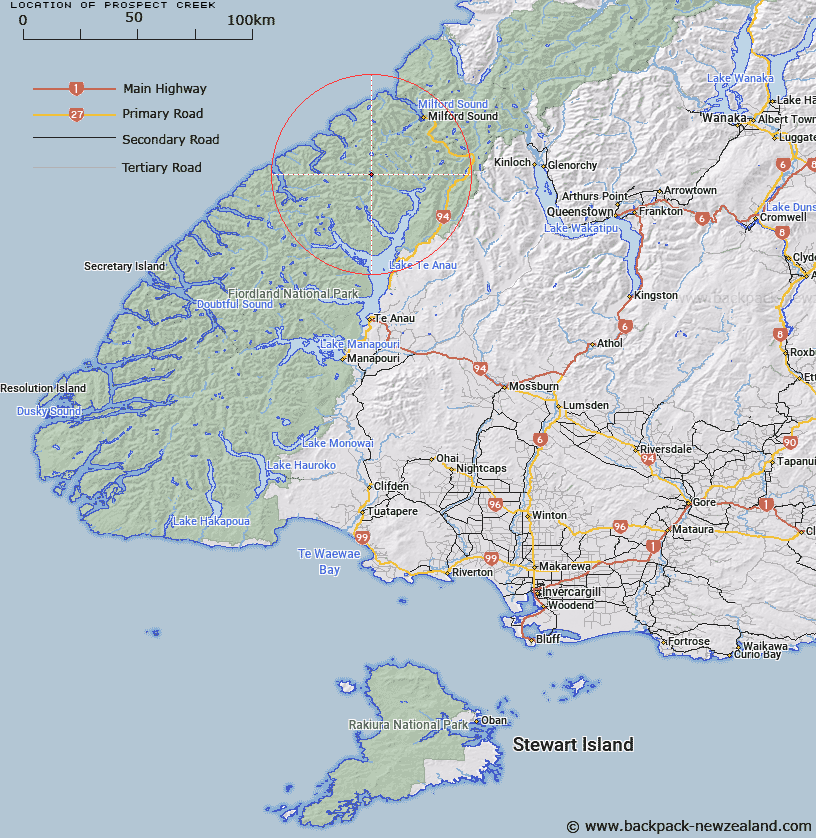
Map showing location of Prospect Creek


LINZ description: Tributary of Worsley Stream, rising East of Hunter Pass and flowing southward through Lakes Sumor and Brownlee, joining the Worsley Stream West of Terminus Creek.
Latitude: -44.881051
Longitude: 167.724211
Northing: 5016707.2
Easting: 1183325
Land District: Southland
Feat Type: Stream


Scroll down to see a more detailed road map and below that a topographical map showing the location of Prospect Creek. The road map has been supplied by openstreetmap and the topographical map of Prospect Creek has been supplied by Land Information New Zealand (LINZ).

Yes you can use the top static map for you school/university project or personal website with a link back. Contact me for any commercial use.

Prospect Creek Map New Zealand


New Zealand places in our database
[ A ] [ B ] [ C ] [ D ] [ E ] [ F ] [ G ] [ H ] [ I ] [ J ] [ K ] [ L ] [ M ] [ N ] [ O ] [ P ] [ Q ] [ R ] [ S ] [ T ] [ U ] [ V ] [ W ] [ X ] [ Y ] [ Z ]


Closest 20 Streams to Prospect Creek

Terminus Creek ( 2.67km )   Worsley Stream ( 3.04km )   Starvation Creek ( 4.17km )   Dark River ( 5.37km )   Castle River ( 6.01km )   Robb Creek ( 6.17km )   Clinton River West Branch ( 8.13km )   Nitz Creek ( 8.59km )   Kakapo Creek ( 8.65km )   McQueen Creek ( 8.68km )   Taheke Creek ( 9.39km )   Bernard Burn ( 9.46km )   Roaring Burn ( 9.91km )   Staircase Creek ( 9.99km )   Saints Creek ( 10.62km )   Indecision Creek ( 10.92km )   Glaisnock River ( 11.13km )   Newton Creek ( 11.63km )   Clinton River North Branch ( 12.08km )   Wild Natives River ( 12.25km )   Epidote Cataract ( 12.3km )   Light River ( 12.64km )   Henderson Burn ( 12.71km )   Pitt River ( 12.97km )   Arthur River ( 13.08km )   Narrows Creek ( 13.36km )   Midnight Creek ( 13.49km )   Clinton River ( 14.27km )   Joes River ( 14.73km )   Billy Burn ( 15.8km )   Inaccessible Creek ( 15.92km )   Surprise Creek ( 16.93km )   Diamond Creek ( 17.52km )   Glade Burn ( 18.66km )   George River ( 18.67km )   Mackay Creek ( 18.91km )   Talbot River ( 19.01km )   McDonald Creek ( 19.22km )   Canyon Creek ( 19.66km )   Edith River ( 19.87km )