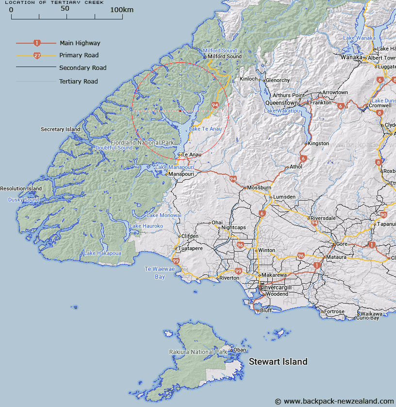
Map showing location of Tertiary Creek


LINZ description: Stream flowing into North Fiord, 3.2km North-west of Shelter Point, Lake Te Anau, from South-west of Halfway Peak. Arran and Eglinton Survey Districts.
Latitude: -45.081866
Longitude: 167.72436
Northing: 4994400
Easting: 1184792.9
Land District: Southland
Feat Type: Stream


Scroll down to see a more detailed road map and below that a topographical map showing the location of Tertiary Creek. The road map has been supplied by openstreetmap and the topographical map of Tertiary Creek has been supplied by Land Information New Zealand (LINZ).

Yes you can use the top static map for you school/university project or personal website with a link back. Contact me for any commercial use.

Tertiary Creek Map New Zealand


New Zealand places in our database
[ A ] [ B ] [ C ] [ D ] [ E ] [ F ] [ G ] [ H ] [ I ] [ J ] [ K ] [ L ] [ M ] [ N ] [ O ] [ P ] [ Q ] [ R ] [ S ] [ T ] [ U ] [ V ] [ W ] [ X ] [ Y ] [ Z ]


Closest 20 Streams to Tertiary Creek

Lugar Burn ( 3.31km )   Mid Burn ( 3.54km )   Loch Burn ( 7km )   Austral Creek ( 7.22km )   Inaccessible Creek ( 9.04km )   Narrows Creek ( 9.44km )   Newton Creek ( 10.7km )   Billy Burn ( 11.24km )   Henderson Burn ( 11.75km )   Glaisnock River ( 12.05km )   Canyon Creek ( 12.54km )   Nitz Creek ( 13.86km )   McIvor Burn ( 14.43km )   Kakapo Creek ( 14.94km )   Saints Creek ( 15.09km )   Barrier Stream ( 15.25km )   Rugged Burn ( 15.95km )   Wapiti River ( 15.95km )   Eglinton River ( 16.31km )   Snag Burn ( 16.31km )   Taheke Creek ( 16.33km )   Midnight Creek ( 17.32km )   Rugged Burn ( 17.38km )   West Burn ( 17.38km )   Retford Stream ( 18.58km )   Dunton Creek ( 18.82km )   Pisgah Creek ( 18.87km )   Henry Creek ( 18.99km )   Fifteen Mile Creek ( 19.26km )   Stillwater River ( 19.34km )   McQueen Creek ( 19.45km )   Worsley Stream ( 19.66km )   Nurse Creek ( 19.95km )   Doon River ( 20.33km )   Boyd Creek ( 20.34km )   Ettrick Burn ( 20.42km )   Castle River ( 20.51km )   Walker Creek ( 20.52km )   Woodrow Burn ( 21.22km )   Terminus Creek ( 21.44km )