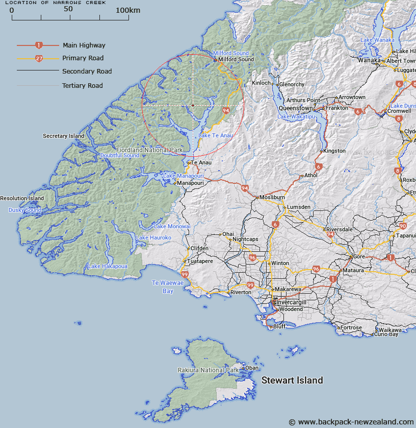
Map showing location of Narrows Creek


LINZ description: Stream rising 1.5km South-east of Mount Kane in the Franklin Mountains, and flowing southward into North Fiord, Lake Te Anau, adjacent to the "Narrows". Clinton Survey District.
Latitude: -44.999438
Longitude: 167.752976
Northing: 5003703.6
Easting: 1186450
Land District: Southland
Feat Type: Stream


Scroll down to see a more detailed road map and below that a topographical map showing the location of Narrows Creek. The road map has been supplied by openstreetmap and the topographical map of Narrows Creek has been supplied by Land Information New Zealand (LINZ).

Yes you can use the top static map for you school/university project or personal website with a link back. Contact me for any commercial use.

Narrows Creek Map New Zealand


New Zealand places in our database
[ A ] [ B ] [ C ] [ D ] [ E ] [ F ] [ G ] [ H ] [ I ] [ J ] [ K ] [ L ] [ M ] [ N ] [ O ] [ P ] [ Q ] [ R ] [ S ] [ T ] [ U ] [ V ] [ W ] [ X ] [ Y ] [ Z ]


Closest 20 Streams to Narrows Creek

Newton Creek ( 2.82km )   Billy Burn ( 5.26km )   Nitz Creek ( 5.77km )   Glaisnock River ( 5.91km )   Saints Creek ( 6.06km )   Henderson Burn ( 7.39km )   Inaccessible Creek ( 7.79km )   Kakapo Creek ( 7.94km )   Lugar Burn ( 8.22km )   Tertiary Creek ( 9.44km )   McQueen Creek ( 10.23km )   Taheke Creek ( 10.26km )   Worsley Stream ( 11.06km )   Castle River ( 11.08km )   Austral Creek ( 11.29km )   Terminus Creek ( 12.13km )   Mid Burn ( 12.24km )   Indecision Creek ( 13.03km )   Prospect Creek ( 13.36km )   Midnight Creek ( 13.53km )   Canyon Creek ( 13.61km )   Nurse Creek ( 14.45km )   Loch Burn ( 15.54km )   Wapiti River ( 16.16km )   Rugged Burn ( 16.16km )   Clinton River ( 16.34km )   Starvation Creek ( 16.67km )   Clinton River West Branch ( 17.11km )   Robb Creek ( 17.2km )   Pitt River ( 17.38km )   Bernard Burn ( 17.71km )   Barrier Stream ( 18km )   Rugged Burn ( 18.26km )   West Burn ( 18.26km )   Glade Burn ( 18.32km )   Dark River ( 18.49km )   Eglinton River ( 19.06km )   Murcott Burn ( 19.24km )   Wild Natives River ( 19.25km )   Clinton River North Branch ( 20.1km )