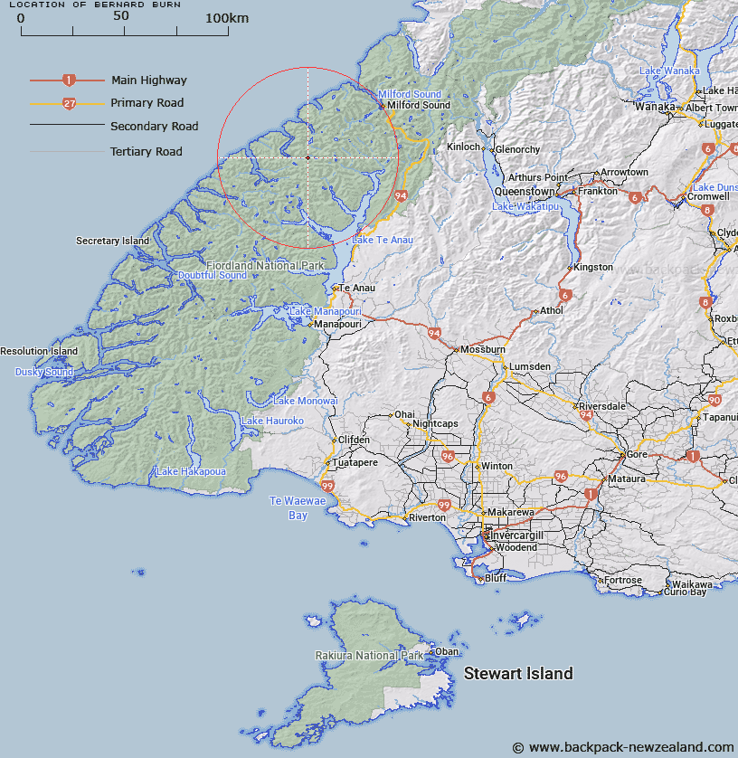
Map showing location of Bernard Burn


LINZ description: Middle branch tributary of the Wild Natives River. Part in Glaisnock Survey District.
Latitude: -44.880032
Longitude: 167.604127
Northing: 5016195.3
Easting: 1173833.3
Land District: Southland
Feat Type: Stream


Scroll down to see a more detailed road map and below that a topographical map showing the location of Bernard Burn. The road map has been supplied by openstreetmap and the topographical map of Bernard Burn has been supplied by Land Information New Zealand (LINZ).

Yes you can use the top static map for you school/university project or personal website with a link back. Contact me for any commercial use.

Bernard Burn Map New Zealand


New Zealand places in our database
[ A ] [ B ] [ C ] [ D ] [ E ] [ F ] [ G ] [ H ] [ I ] [ J ] [ K ] [ L ] [ M ] [ N ] [ O ] [ P ] [ Q ] [ R ] [ S ] [ T ] [ U ] [ V ] [ W ] [ X ] [ Y ] [ Z ]


Closest 20 Streams to Bernard Burn

Wild Natives River ( 2.84km )   Robb Creek ( 4.1km )   Pitt River ( 4.91km )   Starvation Creek ( 6.63km )   Taheke Creek ( 8.03km )   Dark River ( 8.16km )   Worsley Stream ( 8.57km )   Midnight Creek ( 8.69km )   Prospect Creek ( 9.46km )   McDonald Creek ( 9.79km )   Kakapo Creek ( 9.86km )   George River ( 10.01km )   Light River ( 10.88km )   Stina Burn ( 11.82km )   Nitz Creek ( 11.97km )   Terminus Creek ( 11.97km )   Edith River ( 12.45km )   Glaisnock River ( 12.53km )   Henderson Burn ( 12.63km )   Staircase Creek ( 13.99km )   Trophy Burn ( 14.89km )   Newton Creek ( 15.01km )   Castle River ( 15.14km )   Wapiti River ( 15.2km )   Rugged Burn ( 15.2km )   Inaccessible Creek ( 15.68km )   Roaring Burn ( 15.71km )   Canyon Creek ( 16.48km )   West Burn ( 16.68km )   Rugged Burn ( 16.68km )   Clinton River West Branch ( 17.24km )   Nita Creek ( 17.28km )   McQueen Creek ( 17.54km )   Katherine Creek ( 17.64km )   Narrows Creek ( 17.71km )   Arthur River ( 17.78km )   Saints Creek ( 17.95km )   Overlander Stream ( 19.28km )   Barrier Stream ( 19.67km )   Austral Creek ( 20.19km )