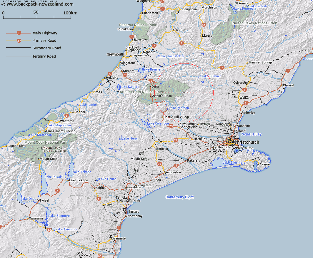
Map showing location of Poulter Hill


LINZ description: Hill at the southern end of The Candlesticks, near Bull Creek and Poulter River East Branch, a tributary of the Waimakariri
Latitude: -42.902259
Longitude: 171.998891
Northing: 5249553
Easting: 1518271.7
Land District: Canterbury
Feat Type: Hill


Scroll down to see a more detailed road map and below that a topographical map showing the location of Poulter Hill. The road map has been supplied by openstreetmap and the topographical map of Poulter Hill has been supplied by Land Information New Zealand (LINZ).

Yes you can use the top static map for you school/university project or personal website with a link back. Contact me for any commercial use.

Poulter Hill Map New Zealand


New Zealand places in our database
[ A ] [ B ] [ C ] [ D ] [ E ] [ F ] [ G ] [ H ] [ I ] [ J ] [ K ] [ L ] [ M ] [ N ] [ O ] [ P ] [ Q ] [ R ] [ S ] [ T ] [ U ] [ V ] [ W ] [ X ] [ Y ] [ Z ]


Closest 20 Hills to Poulter Hill

Shingle Hill ( 4.25km )   Big Flora ( 4.81km )   Gray Hill ( 6.43km )   Mount Turnbull ( 7.1km )   K?nuka Hills ( 7.96km )   Nigger Hill ( 7.96km )   Forest Peak ( 8.38km )   Little Flora ( 8.67km )   Surveyors Knob ( 10.55km )   Dampier Corner ( 11.95km )   Mount Row ( 12.62km )   Brown Hill ( 12.74km )   Peveril Peak ( 12.89km )   Mount Crossley ( 13.34km )   Castle Hill ( 13.51km )   Mount White ( 13.62km )   Lookout Peak ( 15.13km )   Little Peveril ( 15.2km )   Green Hill ( 15.2km )   Mount Morrison ( 15.98km )   White Spur ( 16.16km )   Puketeraki ( 16.68km )   Sugar Loaf ( 17.34km )   Mount Binser ( 17.87km )   Lake Hill ( 17.97km )   Valiant Mountain ( 17.99km )   Island Hills ( 18.18km )   Mount Pember ( 18.34km )   Scarface Mountain ( 18.75km )   Smooth Peak ( 19.17km )   Ashley Head ( 19.26km )   Top of the Ladder ( 19.35km )   Woolshed Hill ( 19.45km )   Howitt Peak ( 19.46km )   Tainui Peak ( 19.51km )   Blake Peak ( 19.51km )   Lillburn Hill ( 19.57km )   Lilburne Hill ( 19.57km )   Bell Knoll ( 19.57km )   Devils Den ( 19.58km )