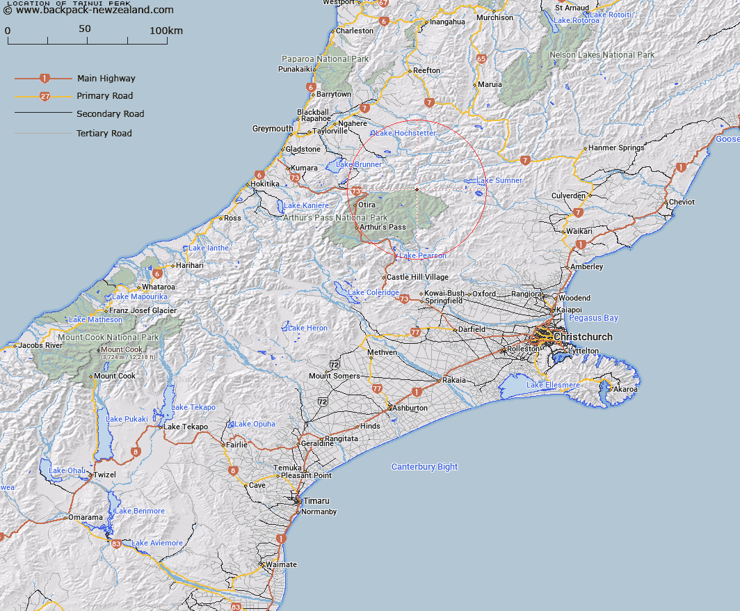
Map showing location of Tainui Peak


LINZ description: Peak ( 1745 m) overlooking the Hurunui River, situated at the junction of Poulter, Dampier and Crawford Ranges.
Latitude: -42.742558
Longitude: 171.899805
Northing: 5267186.2
Easting: 1509951
Land District: Canterbury
Feat Type: Hill


Scroll down to see a more detailed road map and below that a topographical map showing the location of Tainui Peak. The road map has been supplied by openstreetmap and the topographical map of Tainui Peak has been supplied by Land Information New Zealand (LINZ).

Yes you can use the top static map for you school/university project or personal website with a link back. Contact me for any commercial use.

Tainui Peak Map New Zealand


New Zealand places in our database
[ A ] [ B ] [ C ] [ D ] [ E ] [ F ] [ G ] [ H ] [ I ] [ J ] [ K ] [ L ] [ M ] [ N ] [ O ] [ P ] [ Q ] [ R ] [ S ] [ T ] [ U ] [ V ] [ W ] [ X ] [ Y ] [ Z ]


Closest 20 Hills to Tainui Peak

Howitt Peak ( 3.05km )   Mount Drake ( 3.09km )   Mount Byrne ( 3.23km )   Mount Wilson ( 4.4km )   Lookout Peak ( 5.16km )   Mount Wilkinson ( 6.7km )   Mount Monotis ( 6.77km )   Mount Row ( 7.04km )   Mount Dixon ( 7.14km )   Blake Peak ( 7.96km )   Mount Stapp ( 8.87km )   Mount Morrison ( 9.14km )   Mount Tuke ( 9.26km )   Mount Elizabeth ( 10.25km )   Mount Koeti ( 11.46km )   Mount Fraser ( 12.86km )   Scarface Mountain ( 12.91km )   Mount McRae ( 14.54km )   Terrible Knob ( 14.99km )   Dinner Hill ( 15.39km )   Green Hill ( 15.61km )   Isolated Hill ( 16.37km )   Forest Peak ( 16.64km )   Castle Hill ( 16.74km )   Mount Mason ( 17.28km )   Mount Newcombe ( 17.5km )   Mount Turnbull ( 17.56km )   Mount Ranunculus ( 18.09km )   Mount O'Shanessy ( 18.19km )   Valiant Mountain ( 18.85km )   Mount Crossley ( 19.25km )   Mount Hunt ( 19.34km )   Poulter Hill ( 19.51km )   Smooth Peak ( 19.66km )   Rugged Peaks ( 19.68km )   Mount Pfeifer ( 19.68km )   Mount Howe ( 20.42km )   Shingle Hill ( 20.88km )   Macs Knob ( 20.91km )   One Shot Hill ( 21.31km )