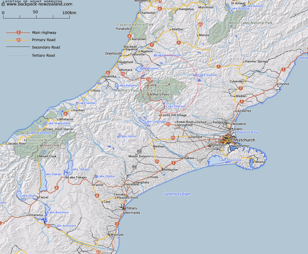
Map showing location of Mount Morrison


LINZ description: Description in Gazette does not match the location of the peak. Added to Gaz Anomalies List.
Latitude: -42.813929
Longitude: 171.844191
Northing: 5259200
Easting: 1505507.6
Land District: Canterbury
Feat Type: Hill


Scroll down to see a more detailed road map and below that a topographical map showing the location of Mount Morrison. The road map has been supplied by openstreetmap and the topographical map of Mount Morrison has been supplied by Land Information New Zealand (LINZ).

Yes you can use the top static map for you school/university project or personal website with a link back. Contact me for any commercial use.

Mount Morrison Map New Zealand


New Zealand places in our database
[ A ] [ B ] [ C ] [ D ] [ E ] [ F ] [ G ] [ H ] [ I ] [ J ] [ K ] [ L ] [ M ] [ N ] [ O ] [ P ] [ Q ] [ R ] [ S ] [ T ] [ U ] [ V ] [ W ] [ X ] [ Y ] [ Z ]


Closest 20 Hills to Mount Morrison

Scarface Mountain ( 4.49km )   Mount Wilkinson ( 6.03km )   Mount Koeti ( 6.23km )   Mount Row ( 6.47km )   Green Hill ( 6.54km )   Mount Byrne ( 7.31km )   Mount McRae ( 7.39km )   Castle Hill ( 7.98km )   Tainui Peak ( 9.14km )   Forest Peak ( 9.7km )   Valiant Mountain ( 9.72km )   Lookout Peak ( 9.84km )   Mount Hunt ( 10.48km )   Smooth Peak ( 10.56km )   Rugged Peaks ( 10.68km )   Mount Wilson ( 10.82km )   Mount Dixon ( 11.19km )   Mount Drake ( 11.54km )   Howitt Peak ( 11.61km )   Brown Hill ( 13.7km )   Mount Pfeifer ( 13.82km )   Mount Monotis ( 14.38km )   Mount Elizabeth ( 15.44km )   Blake Peak ( 15.66km )   Mount Tarapuhi ( 15.9km )   Falling Mountain ( 15.94km )   Poulter Hill ( 15.98km )   Mount Russel ( 16.09km )   Mount Franklin ( 16.29km )   One Shot Hill ( 16.35km )   Mount Turnbull ( 17.64km )   Woolshed Hill ( 17.77km )   Mount Stapp ( 17.99km )   Mount Scott ( 18.26km )   Gray Hill ( 18.36km )   Mount Tuke ( 18.39km )   Mount Howe ( 18.51km )   Mount Oates ( 18.72km )   Mount Wilson ( 18.82km )   Shingle Hill ( 19.02km )