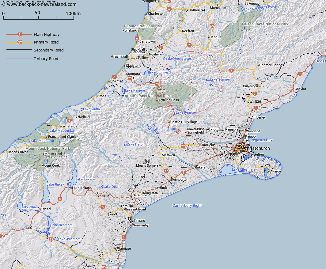
Map showing location of Blake Peak


LINZ description: Peak on the Crawford Range west of Lake Sumner. Overlooks headwaters of Hurunui River.
Latitude: -42.726781
Longitude: 171.994913
Northing: 5269035.3
Easting: 1517714.7
Land District: Canterbury
Feat Type: Hill


Scroll down to see a more detailed road map and below that a topographical map showing the location of Blake Peak. The road map has been supplied by openstreetmap and the topographical map of Blake Peak has been supplied by Land Information New Zealand (LINZ).

Yes you can use the top static map for you school/university project or personal website with a link back. Contact me for any commercial use.

Blake Peak Map New Zealand


New Zealand places in our database
[ A ] [ B ] [ C ] [ D ] [ E ] [ F ] [ G ] [ H ] [ I ] [ J ] [ K ] [ L ] [ M ] [ N ] [ O ] [ P ] [ Q ] [ R ] [ S ] [ T ] [ U ] [ V ] [ W ] [ X ] [ Y ] [ Z ]


Closest 20 Hills to Blake Peak

Howitt Peak ( 4.95km )   Lookout Peak ( 6.16km )   Mount Tuke ( 6.6km )   Terrible Knob ( 7.05km )   Mount Stapp ( 7.52km )   Dinner Hill ( 7.68km )   Tainui Peak ( 7.96km )   Isolated Hill ( 8.55km )   Mount Drake ( 8.65km )   Mount Row ( 10.41km )   Mount Byrne ( 11.19km )   Mount Wilson ( 11.2km )   Mount Monotis ( 11.22km )   Macs Knob ( 13.11km )   Mount Crossley ( 13.87km )   Mount Dixon ( 14.27km )   Mount Wilkinson ( 14.64km )   Mount Turnbull ( 14.81km )   Bell Knoll ( 14.89km )   Mount Morrison ( 15.66km )   Mount Elizabeth ( 15.98km )   Mount Ajax ( 16.37km )   Mount Ranunculus ( 16.47km )   Mount Fraser ( 16.65km )   Island Hills ( 18.3km )   Niggerhead ( 18.45km )   Tawhai Hill ( 18.45km )   Shingle Hill ( 19.19km )   Mount Koeti ( 19.27km )   Poulter Hill ( 19.51km )   Dampier Corner ( 19.73km )   Mount Newcombe ( 19.78km )   Scarface Mountain ( 19.98km )   Forest Peak ( 20.05km )   Conical Hill ( 21.23km )   Green Hill ( 21.46km )   Mount Mason ( 21.51km )   Castle Hill ( 21.95km )   Mount McRae ( 22.11km )   Big Flora ( 22.58km )