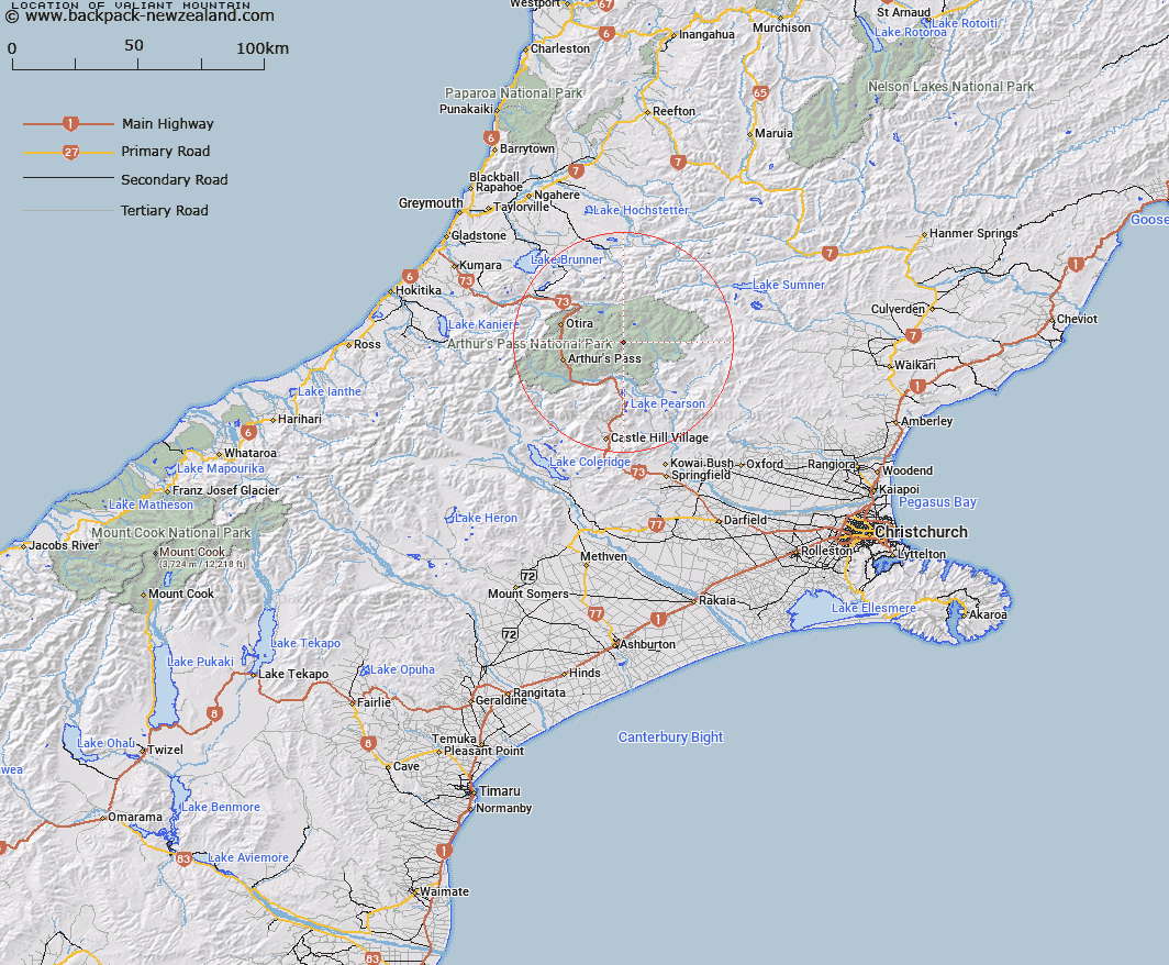
Map showing location of Valiant Mountain


LINZ description: On the Savannah Range near the head of the East Hawdon
Latitude: -42.887095
Longitude: 171.779053
Northing: 5251000
Easting: 1500300
Land District: Canterbury
Feat Type: Hill


Scroll down to see a more detailed road map and below that a topographical map showing the location of Valiant Mountain. The road map has been supplied by openstreetmap and the topographical map of Valiant Mountain has been supplied by Land Information New Zealand (LINZ).

Yes you can use the top static map for you school/university project or personal website with a link back. Contact me for any commercial use.

Valiant Mountain Map New Zealand


New Zealand places in our database
[ A ] [ B ] [ C ] [ D ] [ E ] [ F ] [ G ] [ H ] [ I ] [ J ] [ K ] [ L ] [ M ] [ N ] [ O ] [ P ] [ Q ] [ R ] [ S ] [ T ] [ U ] [ V ] [ W ] [ X ] [ Y ] [ Z ]


Closest 20 Hills to Valiant Mountain

Smooth Peak ( 1.21km )   Rugged Peaks ( 2.13km )   Mount Hunt ( 2.94km )   Green Hill ( 3.72km )   Castle Hill ( 4.54km )   Scarface Mountain ( 6.68km )   Falling Mountain ( 7.6km )   Brown Hill ( 8km )   Mount McRae ( 8.03km )   Woolshed Hill ( 8.76km )   Mount Scott ( 9.07km )   The Pyramid Peak ( 9.53km )   Mount Wilson ( 9.57km )   Forest Peak ( 9.62km )   Mount Morrison ( 9.72km )   Mount Franklin ( 9.92km )   Mount Oates ( 10.58km )   Mount Koeti ( 10.8km )   Mount Russel ( 11.16km )   Mount Bowers ( 11.2km )   Mount Foweraker ( 11.69km )   Mount Pfeifer ( 12.32km )   Mount Tarapuhi ( 12.94km )   Dome ( 13.73km )   Mount Wilkinson ( 14.33km )   Corner Knob ( 14.78km )   Mount Williams ( 14.87km )   Mount Row ( 14.91km )   Cass Hill ( 15.11km )   One Shot Hill ( 15.33km )   Mount Temple ( 15.33km )   Phipps Peak ( 15.34km )   Mount Aicken ( 15.49km )   Blimit ( 15.59km )   Goat Hill ( 16.07km )   Mount Cassidy ( 16.19km )   Mount Horrible ( 16.35km )   Mount O'Malley ( 16.42km )   Sugar Loaf ( 16.65km )   Mount Byrne ( 16.72km )