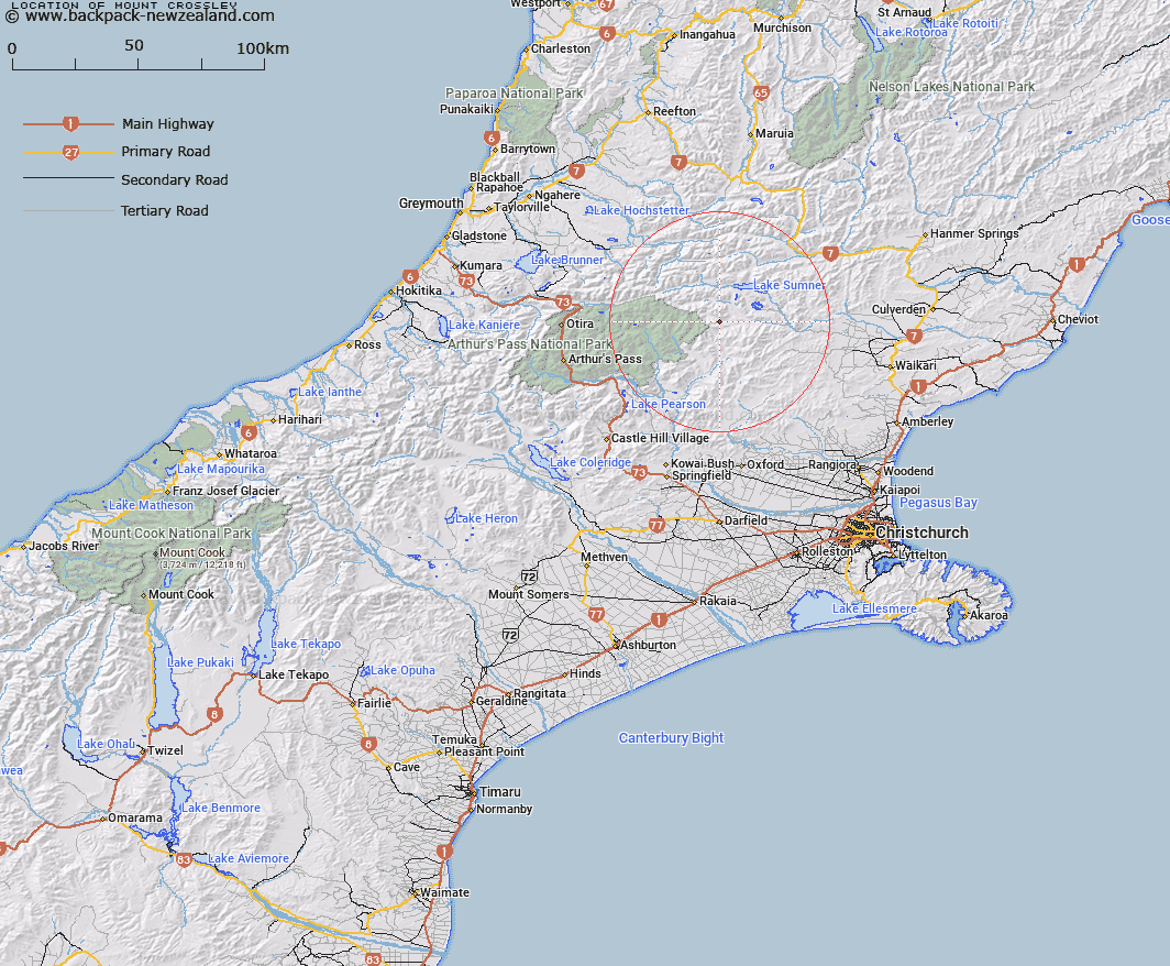
Map showing location of Mount Crossley


LINZ description: 1890m mountain at the north end of The Candlesticks where the range crosses the Dampier Range, at the headwaters of the Waimakariri River.
Latitude: -42.816328
Longitude: 172.11316
Northing: 5259200
Easting: 1527500
Land District: Canterbury
Feat Type: Hill


Scroll down to see a more detailed road map and below that a topographical map showing the location of Mount Crossley. The road map has been supplied by openstreetmap and the topographical map of Mount Crossley has been supplied by Land Information New Zealand (LINZ).

Yes you can use the top static map for you school/university project or personal website with a link back. Contact me for any commercial use.

Mount Crossley Map New Zealand


New Zealand places in our database
[ A ] [ B ] [ C ] [ D ] [ E ] [ F ] [ G ] [ H ] [ I ] [ J ] [ K ] [ L ] [ M ] [ N ] [ O ] [ P ] [ Q ] [ R ] [ S ] [ T ] [ U ] [ V ] [ W ] [ X ] [ Y ] [ Z ]


Closest 20 Hills to Mount Crossley

Island Hills ( 5.94km )   Bell Knoll ( 6.23km )   Dampier Corner ( 6.27km )   Mount Turnbull ( 6.31km )   Shingle Hill ( 10.11km )   Terrible Knob ( 11km )   Top of the Ladder ( 11.25km )   Esk Head ( 11.54km )   Conical Hill ( 12.22km )   Big Flora ( 13.3km )   Poulter Hill ( 13.34km )   Blake Peak ( 13.87km )   Isolated Hill ( 14.11km )   Lookout Peak ( 14.26km )   Dinner Hill ( 14.56km )   Mount Row ( 15.64km )   Macs Knob ( 16.08km )   Little Sisters ( 16.47km )   Little Flora ( 16.63km )   Cherry Tree Hill ( 16.8km )   Howitt Peak ( 17.2km )   Surveyors Knob ( 17.88km )   Ashley Head ( 18.1km )   Niggerhead ( 18.13km )   Tawhai Hill ( 18.13km )   Nigger Hill ( 18.3km )   K?nuka Hills ( 18.3km )   Devils Den ( 18.72km )   Mount Whatno ( 18.75km )   Mount Meehan ( 19.15km )   Tainui Peak ( 19.25km )   Forest Peak ( 19.54km )   Gray Hill ( 19.56km )   Mount Longfellow ( 20.03km )   The Monument ( 20.03km )   Mount Tuke ( 20.21km )   Virginia Peak ( 20.25km )   Mount Stapp ( 21.3km )   Mount Drake ( 21.37km )   Mount Emerson ( 21.66km )