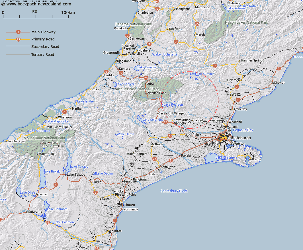
Map showing location of Lillburn Hill


LINZ description: Mountain at height 1405m, between the Puketeraki Range and the Pancake Range and near the headwaters of the Ashley River/Rakahuri
Latitude: -43.034004
Longitude: 172.158307
Northing: 5235065.4
Easting: 1531432.7
Land District: Canterbury
Feat Type: Hill


Scroll down to see a more detailed road map and below that a topographical map showing the location of Lillburn Hill. The road map has been supplied by openstreetmap and the topographical map of Lillburn Hill has been supplied by Land Information New Zealand (LINZ).

Yes you can use the top static map for you school/university project or personal website with a link back. Contact me for any commercial use.

Lillburn Hill Map New Zealand


New Zealand places in our database
[ A ] [ B ] [ C ] [ D ] [ E ] [ F ] [ G ] [ H ] [ I ] [ J ] [ K ] [ L ] [ M ] [ N ] [ O ] [ P ] [ Q ] [ R ] [ S ] [ T ] [ U ] [ V ] [ W ] [ X ] [ Y ] [ Z ]


Closest 20 Hills to Lillburn Hill

Pancake Hill ( 4.04km )   Puketeraki ( 5.26km )   Mount Pember ( 6.58km )   Spring Hill ( 6.61km )   Island Hill ( 7.7km )   Surveyors Knob ( 9.03km )   Mount Gordon ( 9.26km )   Devils Den ( 9.49km )   Ashley Head ( 9.98km )   Little Flora ( 10.9km )   Ashley Hill ( 12.38km )   Nigger Hill ( 12.53km )   K?nuka Hills ( 12.53km )   Mount Storm ( 12.78km )   Retreat Hill ( 12.86km )   Chest Peak ( 13.61km )   Mount Whatno ( 14.15km )   Okuku Hill ( 14.25km )   White Spur ( 14.75km )   Block Hill ( 14.8km )   Big Flora ( 14.97km )   Sugar Loaf ( 15.69km )   Mount White ( 15.87km )   Mount Richardson ( 17.1km )   Mount Meehan ( 17.19km )   Lake Hill ( 17.26km )   Gola Peak ( 17.65km )   Shingle Hill ( 17.83km )   Gray Hill ( 18.16km )   Ladbrooks Hill ( 18.2km )   Dampier Corner ( 18.36km )   Whale Hill ( 18.73km )   Top of the Ladder ( 19.39km )   The Monument ( 19.44km )   Little Peveril ( 19.54km )   Poulter Hill ( 19.57km )   Round Hill ( 19.97km )   Esk Head ( 20km )   Peveril Peak ( 20.08km )   Bald Hills ( 20.19km )