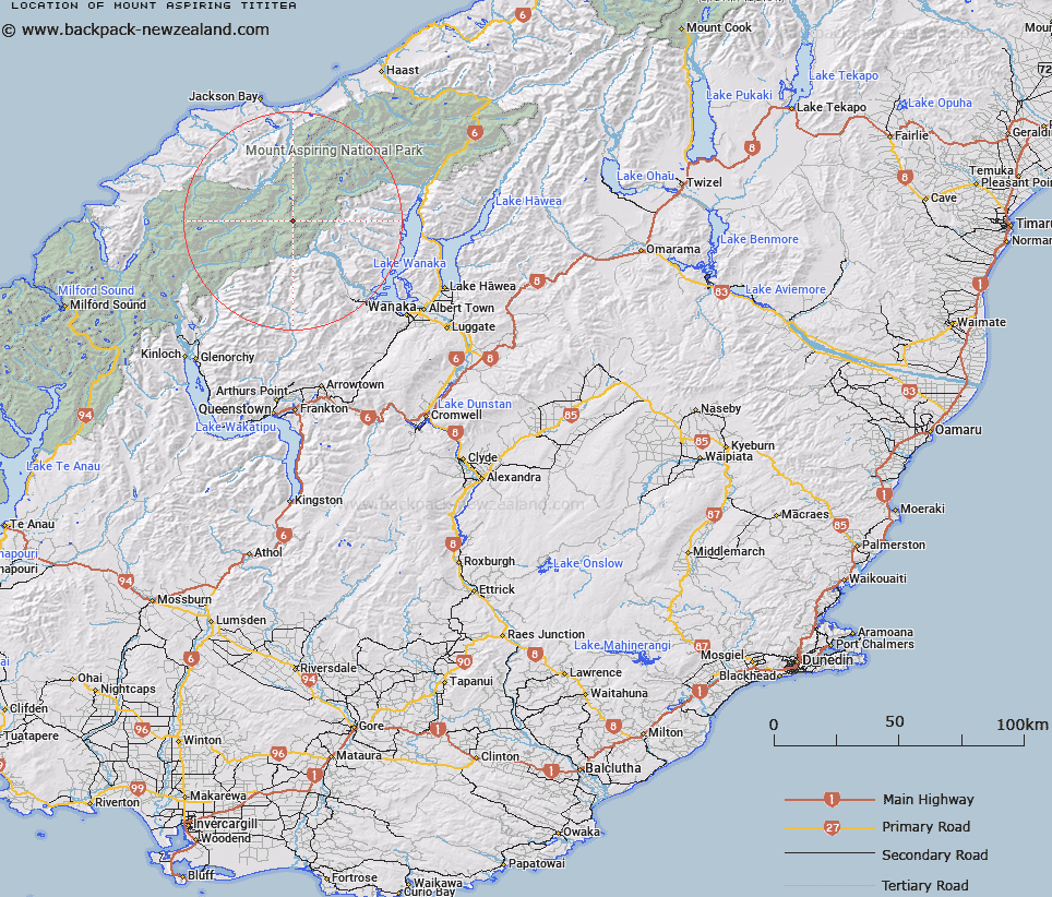
Map showing location of Mount Aspiring/Tititea


LINZ description: Feature shown on: NZMS260-E39 698382; NZTopo50-CA11 597764;
Latitude: -44.385737
Longitude: 168.7278
Northing: 5076400
Easting: 1259700
Land District: Otago, Westland
Feat Type: Hill


Scroll down to see a more detailed road map and below that a topographical map showing the location of Mount Aspiring/Tititea. The road map has been supplied by openstreetmap and the topographical map of Mount Aspiring/Tititea has been supplied by Land Information New Zealand (LINZ).

Yes you can use the top static map for you school/university project or personal website with a link back. Contact me for any commercial use.
Mount Aspiring/Tititea Map New Zealand


New Zealand places in our database
[ A ] [ B ] [ C ] [ D ] [ E ] [ F ] [ G ] [ H ] [ I ] [ J ] [ K ] [ L ] [ M ] [ N ] [ O ] [ P ] [ Q ] [ R ] [ S ] [ T ] [ U ] [ V ] [ W ] [ X ] [ Y ] [ Z ]


Closest 20 Hills to Mount Aspiring/Tititea

Mount Aspiring ( 0km )   Mount Aspiring/Tititea ( 0km )   Popes Nose ( 1.58km )   Scylla and Charybdis ( 2.09km )   Rolling Pin ( 2.85km )   Mount French ( 3.04km )   Mount Joffre ( 3.18km )   Aeroplane Peak ( 3.26km )   Mount Bevan ( 3.4km )   Mainroyal ( 3.64km )   Moncrieff Peak ( 3.99km )   Mount Avalanche ( 4.16km )   Skyscraper ( 4.55km )   Middle Peak ( 4.65km )   East Peak ( 4.82km )   Stargazer ( 4.97km )   Mildewed Meg ( 5.54km )   Mount Barff ( 6.56km )   Fastness Peak ( 6.91km )   Low Peak ( 7.01km )   Spike ( 7.24km )   Duncans Knob ( 7.25km )   Bow Peak ( 7.3km )   Rob Roy Peak ( 7.4km )   Mount Helen ( 8.17km )   Glacier Dome ( 8.37km )   Sisyphus Peak ( 8.38km )   Buncombe ( 8.85km )   Homestead Peak ( 9.15km )   Glengyle Peak ( 9.2km )   Tyler ( 9.27km )   Moonraker ( 9.29km )   Islington Dome ( 9.62km )   Athene Mountain ( 9.66km )   Mount Liverpool ( 9.69km )   Mount Wahine ( 10.4km )   Corner Post ( 10.47km )   Eros ( 10.74km )   Mount Maori ( 10.87km )   Pickelhaube Peak ( 10.94km )