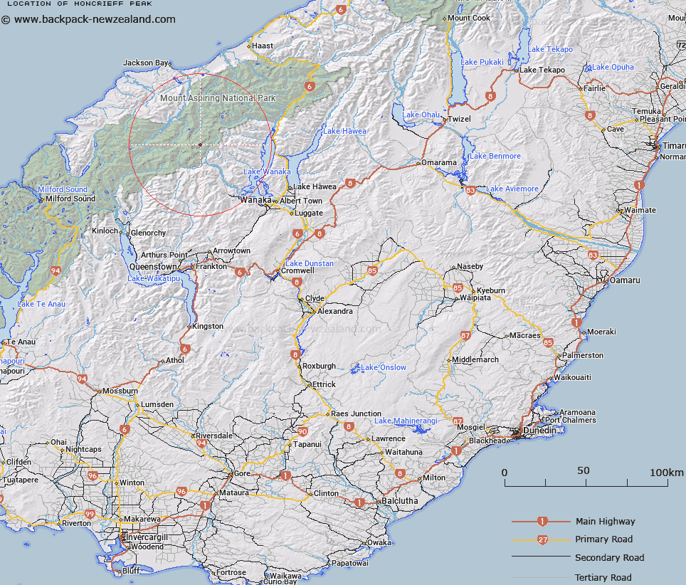
Map showing location of Moncrieff Peak


LINZ description: Peak on the Main Divide, 850m North-east of Aeroplane Peak. Mount Aspiring and Mount Pollux Survey Districts.
Latitude: -44.387773
Longitude: 168.777868
Northing: 5076381
Easting: 1263700
Land District: Otago, Westland
Feat Type: Hill


Scroll down to see a more detailed road map and below that a topographical map showing the location of Moncrieff Peak. The road map has been supplied by openstreetmap and the topographical map of Moncrieff Peak has been supplied by Land Information New Zealand (LINZ).

Yes you can use the top static map for you school/university project or personal website with a link back. Contact me for any commercial use.

Moncrieff Peak Map New Zealand


New Zealand places in our database
[ A ] [ B ] [ C ] [ D ] [ E ] [ F ] [ G ] [ H ] [ I ] [ J ] [ K ] [ L ] [ M ] [ N ] [ O ] [ P ] [ Q ] [ R ] [ S ] [ T ] [ U ] [ V ] [ W ] [ X ] [ Y ] [ Z ]


Closest 20 Hills to Moncrieff Peak

Aeroplane Peak ( 0.84km )   Scylla and Charybdis ( 1.91km )   Popes Nose ( 2.56km )   Fastness Peak ( 3.71km )   Mount Aspiring/Tititea ( 3.99km )   Mount Aspiring ( 3.99km )   Mildewed Meg ( 4.01km )   Sisyphus Peak ( 4.53km )   Duncans Knob ( 4.61km )   Mount Avalanche ( 4.79km )   Middle Peak ( 4.97km )   East Peak ( 5km )   Mount French ( 5.6km )   Mainroyal ( 6.06km )   Rolling Pin ( 6.09km )   Glacier Dome ( 6.17km )   Skyscraper ( 6.64km )   Mount Joffre ( 6.71km )   Stargazer ( 6.96km )   Mount Bevan ( 7.32km )   Low Peak ( 7.52km )   Spike ( 8.27km )   Dragonfly Peak ( 8.4km )   Rob Roy Peak ( 8.43km )   Homestead Peak ( 8.52km )   Pickelhaube Peak ( 8.55km )   Pickelhaube ( 8.63km )   Mount Eostre ( 8.69km )   Mount Helen ( 9.63km )   Moonraker ( 9.99km )   Mount Barff ( 10.21km )   Glengyle Peak ( 10.55km )   Corner Post ( 10.69km )   Bow Peak ( 11.19km )   Mount Taunus ( 11.44km )   Mount Taurus ( 11.44km )   Aspinall Peak ( 11.51km )   Buncombe ( 12.08km )   Lois Peak ( 12.17km )   Islington Dome ( 12.93km )