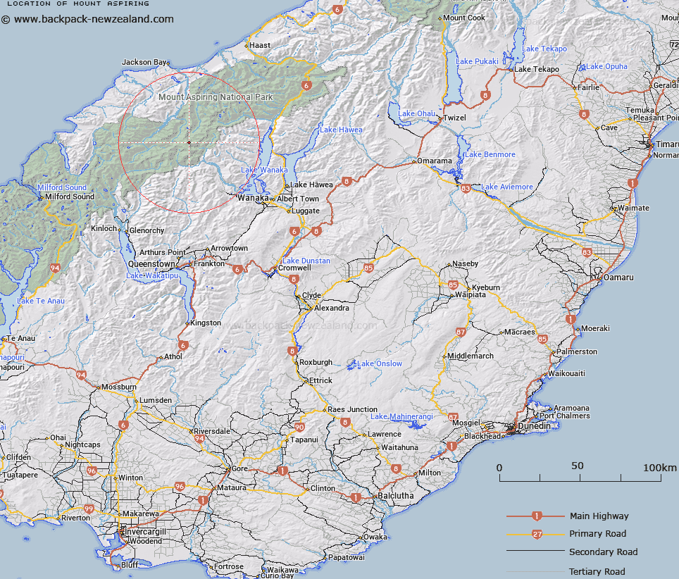
Map showing location of Mount Aspiring


LINZ description: Feature shown on: NZMS260-E39 698382; NZTopo50-CA11 597764;
Latitude: -44.385737
Longitude: 168.7278
Northing: 5076400
Easting: 1259700
Land District: Otago, Westland
Feat Type: Hill


Scroll down to see a more detailed road map and below that a topographical map showing the location of Mount Aspiring. The road map has been supplied by openstreetmap and the topographical map of Mount Aspiring has been supplied by Land Information New Zealand (LINZ).

Yes you can use the top static map for you school/university project or personal website with a link back. Contact me for any commercial use.

Mount Aspiring Map New Zealand


New Zealand places in our database
[ A ] [ B ] [ C ] [ D ] [ E ] [ F ] [ G ] [ H ] [ I ] [ J ] [ K ] [ L ] [ M ] [ N ] [ O ] [ P ] [ Q ] [ R ] [ S ] [ T ] [ U ] [ V ] [ W ] [ X ] [ Y ] [ Z ]


Closest 20 Hills to Mount Aspiring

Mount Aspiring ( 0km )   Mount Aspiring/Tititea ( 0km )   Popes Nose ( 1.58km )   Scylla and Charybdis ( 2.09km )   Rolling Pin ( 2.85km )   Mount French ( 3.04km )   Mount Joffre ( 3.18km )   Aeroplane Peak ( 3.26km )   Mount Bevan ( 3.4km )   Mainroyal ( 3.64km )   Moncrieff Peak ( 3.99km )   Mount Avalanche ( 4.16km )   Skyscraper ( 4.55km )   Middle Peak ( 4.65km )   East Peak ( 4.82km )   Stargazer ( 4.97km )   Mildewed Meg ( 5.54km )   Mount Barff ( 6.56km )   Fastness Peak ( 6.91km )   Low Peak ( 7.01km )   Spike ( 7.24km )   Duncans Knob ( 7.25km )   Bow Peak ( 7.3km )   Rob Roy Peak ( 7.4km )   Mount Helen ( 8.17km )   Glacier Dome ( 8.37km )   Sisyphus Peak ( 8.38km )   Buncombe ( 8.85km )   Homestead Peak ( 9.15km )   Glengyle Peak ( 9.2km )   Tyler ( 9.27km )   Moonraker ( 9.29km )   Islington Dome ( 9.62km )   Athene Mountain ( 9.66km )   Mount Liverpool ( 9.69km )   Mount Wahine ( 10.4km )   Corner Post ( 10.47km )   Eros ( 10.74km )   Mount Maori ( 10.87km )   Pickelhaube Peak ( 10.94km )