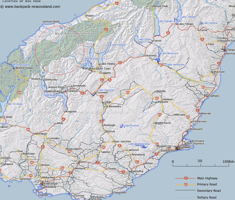
Map showing location of Bow Peak


LINZ description: Between Mount Athene and Waipara Saddle. At the headwaters of Waipara River. 5,340 ft. Cascade Survey District.
Latitude: -44.399439
Longitude: 168.637968
Northing: 5074500
Easting: 1252625.4
Land District: Otago
Feat Type: Hill


Scroll down to see a more detailed road map and below that a topographical map showing the location of Bow Peak. The road map has been supplied by openstreetmap and the topographical map of Bow Peak has been supplied by Land Information New Zealand (LINZ).

Yes you can use the top static map for you school/university project or personal website with a link back. Contact me for any commercial use.

Bow Peak Map New Zealand


New Zealand places in our database
[ A ] [ B ] [ C ] [ D ] [ E ] [ F ] [ G ] [ H ] [ I ] [ J ] [ K ] [ L ] [ M ] [ N ] [ O ] [ P ] [ Q ] [ R ] [ S ] [ T ] [ U ] [ V ] [ W ] [ X ] [ Y ] [ Z ]


Closest 20 Hills to Bow Peak

Mount Barff ( 1.9km )   Athene Mountain ( 2.94km )   Mount Bevan ( 3.9km )   Mount Liverpool ( 3.95km )   Islington Dome ( 4.24km )   Mount Wahine ( 4.31km )   Mount Maori ( 4.63km )   Mount Joffre ( 4.65km )   Maiti-iti ( 4.85km )   Mount Ionia ( 5.38km )   Eros ( 5.7km )   Mount Maruiwi ( 5.91km )   Tyler ( 6.04km )   Plunket Dome ( 6.21km )   Mount French ( 6.34km )   Turks Head ( 6.86km )   Rolling Pin ( 6.89km )   Mount Aspiring ( 7.3km )   Mount Aspiring/Tititea ( 7.3km )   Mount Maoriri ( 7.55km )   Mount Maoriori ( 7.55km )   Pivot Peak ( 7.86km )   Buncombe ( 7.98km )   Mainroyal ( 8.17km )   Mount Avalanche ( 8.57km )   Mount Edward ( 8.58km )   Popes Nose ( 8.63km )   Skyscraper ( 8.82km )   Rob Roy Peak ( 8.86km )   Middle Peak ( 8.98km )   Stargazer ( 9.11km )   Glengyle Peak ( 9.15km )   East Peak ( 9.17km )   Scylla and Charybdis ( 9.29km )   Mount Caria ( 9.44km )   Low Peak ( 9.52km )   Delta Mountain ( 9.54km )   Gamma Mountain ( 9.9km )   Cilicia Peak ( 10.02km )   Marion Tower ( 10.12km )