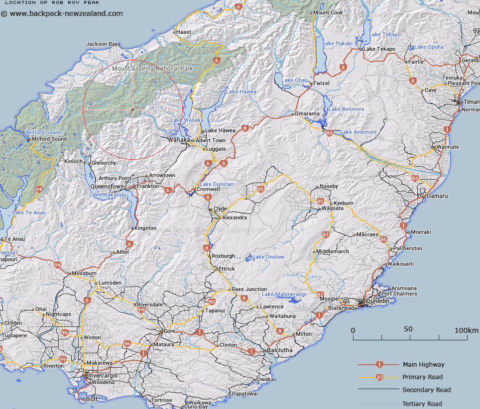
Map showing location of Rob Roy Peak


LINZ description: Peak at the head of the Rob Roy Glacier, which flows into the Matukituki River, west of Lake Wanaka.
Latitude: -44.452125
Longitude: 168.721697
Northing: 5069000
Easting: 1259600
Land District: Otago
Feat Type: Hill


Scroll down to see a more detailed road map and below that a topographical map showing the location of Rob Roy Peak. The road map has been supplied by openstreetmap and the topographical map of Rob Roy Peak has been supplied by Land Information New Zealand (LINZ).

Yes you can use the top static map for you school/university project or personal website with a link back. Contact me for any commercial use.

Rob Roy Peak Map New Zealand


New Zealand places in our database
[ A ] [ B ] [ C ] [ D ] [ E ] [ F ] [ G ] [ H ] [ I ] [ J ] [ K ] [ L ] [ M ] [ N ] [ O ] [ P ] [ Q ] [ R ] [ S ] [ T ] [ U ] [ V ] [ W ] [ X ] [ Y ] [ Z ]


Closest 20 Hills to Rob Roy Peak

Rob Roy Peak ( 0km )   Low Peak ( 1.22km )   Glengyle Peak ( 2.14km )   East Peak ( 3.44km )   Middle Peak ( 3.47km )   Homestead Peak ( 3.63km )   Mount Avalanche ( 3.7km )   Mount French ( 4.51km )   Mildewed Meg ( 5.15km )   Mount Joffre ( 5.79km )   Duncans Knob ( 6.79km )   Mount Barff ( 6.98km )   Popes Nose ( 7.02km )   Mount Bevan ( 7.29km )   Mount Aspiring/Tititea ( 7.4km )   Mount Aspiring ( 7.4km )   Islington Dome ( 7.43km )   Plunket Dome ( 7.49km )   Scylla and Charybdis ( 7.54km )   Aeroplane Peak ( 7.75km )   Mount Liverpool ( 7.85km )   Moncrieff Peak ( 8.43km )   Mount Wahine ( 8.56km )   Bow Peak ( 8.86km )   Red Rock ( 8.96km )   Mount Maori ( 9.01km )   Maiti-iti ( 9.38km )   Glenfinnan Peak ( 9.38km )   Sharks Tooth Peak ( 9.68km )   Rolling Pin ( 9.86km )   Craigroyston Peak ( 10.07km )   Fog Peak ( 10.25km )   Mount Maruiwi ( 10.28km )   Mount Ansted ( 10.29km )   Mount Maoriori ( 10.8km )   Mount Maoriri ( 10.8km )   Mount Tyndall ( 10.8km )   Mount Eostre ( 10.87km )   Mainroyal ( 10.95km )   Mount Edward ( 11km )