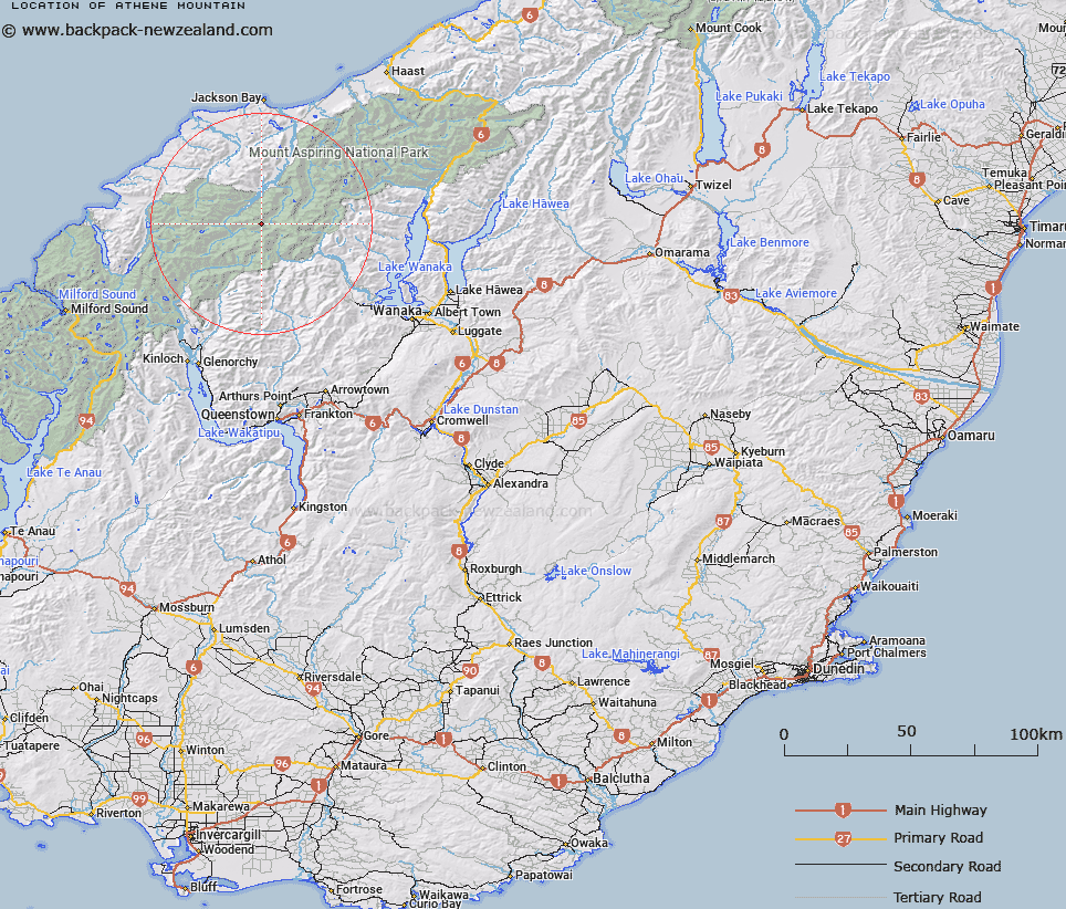
Map showing location of Athene Mountain


LINZ description: The highest peak between Mounts Ionia and Barff. Near the headwaters of Arawata River, and above the Mercer Glacier. 7,140 ft. Cascade Survey District.
Latitude: -44.385908
Longitude: 168.606229
Northing: 5075867.7
Easting: 1250016.9
Land District: Otago
Feat Type: Hill


Scroll down to see a more detailed road map and below that a topographical map showing the location of Athene Mountain. The road map has been supplied by openstreetmap and the topographical map of Athene Mountain has been supplied by Land Information New Zealand (LINZ).

Yes you can use the top static map for you school/university project or personal website with a link back. Contact me for any commercial use.

Athene Mountain Map New Zealand


New Zealand places in our database
[ A ] [ B ] [ C ] [ D ] [ E ] [ F ] [ G ] [ H ] [ I ] [ J ] [ K ] [ L ] [ M ] [ N ] [ O ] [ P ] [ Q ] [ R ] [ S ] [ T ] [ U ] [ V ] [ W ] [ X ] [ Y ] [ Z ]


Closest 20 Hills to Athene Mountain

Mount Ionia ( 2.49km )   Bow Peak ( 2.94km )   Eros ( 3.33km )   Turks Head ( 3.94km )   Tyler ( 4.7km )   Mount Barff ( 4.78km )   Mount Wahine ( 5.52km )   Mount Liverpool ( 5.57km )   Mount Maori ( 5.6km )   Maiti-iti ( 5.62km )   Islington Dome ( 6.02km )   Mount Maruiwi ( 6.31km )   Mount Bevan ( 6.36km )   Mount Caria ( 6.68km )   Cilicia Peak ( 7.31km )   Buncombe ( 7.33km )   Mount Joffre ( 7.41km )   Pivot Peak ( 7.66km )   Plunket Dome ( 7.84km )   Mount Maoriori ( 7.98km )   Mount Maoriri ( 7.98km )   Rolling Pin ( 8.53km )   Delta Mountain ( 9.09km )   Mount Edward ( 9.13km )   Mount French ( 9.17km )   Gamma Mountain ( 9.37km )   Mount Beta ( 9.57km )   Mainroyal ( 9.61km )   Mount Aspiring ( 9.66km )   Mount Aspiring/Tititea ( 9.66km )   The Snowman Peak ( 9.79km )   Alpha Mountain ( 9.81km )   Skyscraper ( 10.04km )   Stargazer ( 10.23km )   Marion Tower ( 10.32km )   Snowden ( 10.57km )   Mount Troas ( 10.76km )   Popes Nose ( 11.12km )   Mount Avalanche ( 11.44km )   Humboldt Tower ( 11.52km )