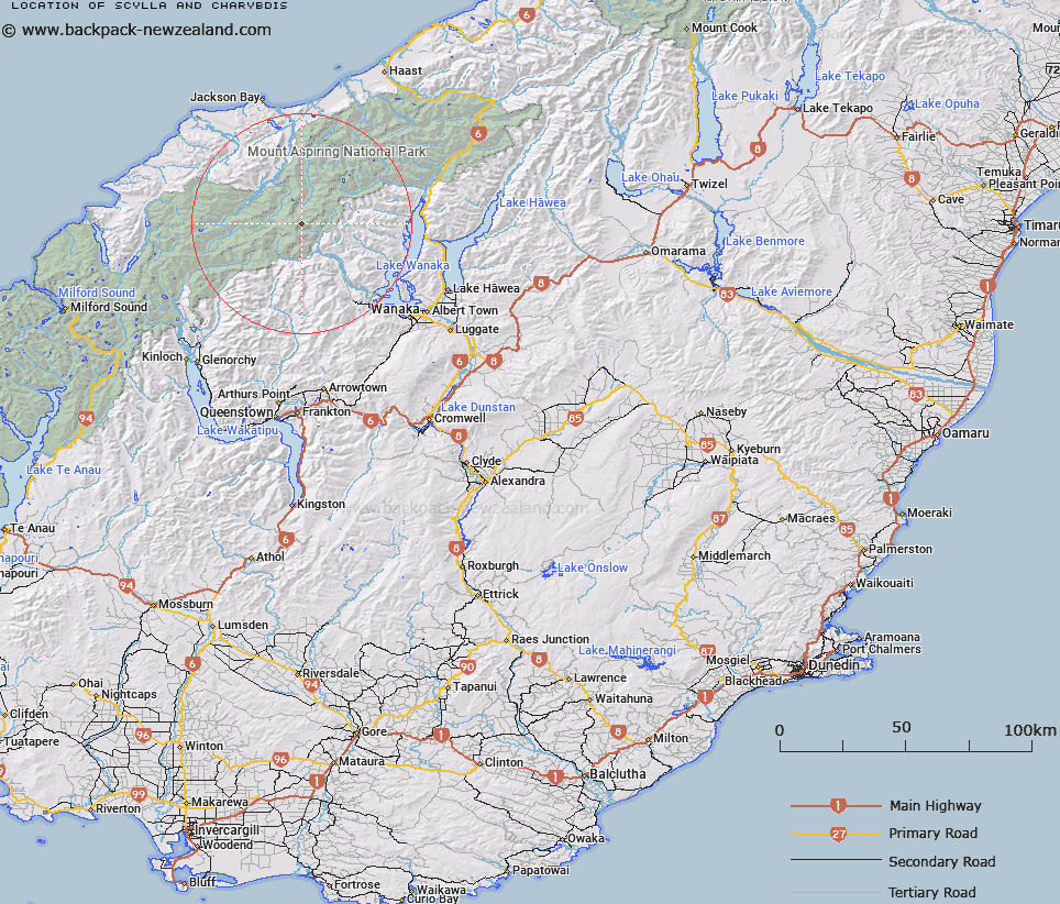
Map showing location of Scylla and Charybdis


LINZ description: The twin minor peaks between Popes Nose (peak) and Aeroplane Peak on the Main Divide in Mt Aspiring National Park
Latitude: -44.388277
Longitude: 168.753838
Northing: 5076225.9
Easting: 1261788.8
Land District: Otago, Westland
Feat Type: Hill


Scroll down to see a more detailed road map and below that a topographical map showing the location of Scylla and Charybdis. The road map has been supplied by openstreetmap and the topographical map of Scylla and Charybdis has been supplied by Land Information New Zealand (LINZ).

Yes you can use the top static map for you school/university project or personal website with a link back. Contact me for any commercial use.

Scylla and Charybdis Map New Zealand


New Zealand places in our database
[ A ] [ B ] [ C ] [ D ] [ E ] [ F ] [ G ] [ H ] [ I ] [ J ] [ K ] [ L ] [ M ] [ N ] [ O ] [ P ] [ Q ] [ R ] [ S ] [ T ] [ U ] [ V ] [ W ] [ X ] [ Y ] [ Z ]


Closest 20 Hills to Scylla and Charybdis

Popes Nose ( 0.71km )   Aeroplane Peak ( 1.18km )   Moncrieff Peak ( 1.91km )   Mount Aspiring/Tititea ( 2.09km )   Mount Aspiring ( 2.09km )   Mount Avalanche ( 3.87km )   Mount French ( 3.99km )   Mildewed Meg ( 4.22km )   Middle Peak ( 4.22km )   East Peak ( 4.33km )   Rolling Pin ( 4.48km )   Mainroyal ( 4.77km )   Mount Joffre ( 4.87km )   Fastness Peak ( 5.2km )   Mount Bevan ( 5.42km )   Skyscraper ( 5.52km )   Duncans Knob ( 5.56km )   Stargazer ( 5.9km )   Sisyphus Peak ( 6.39km )   Low Peak ( 6.84km )   Glacier Dome ( 7.17km )   Rob Roy Peak ( 7.54km )   Spike ( 7.7km )   Mount Barff ( 8.37km )   Homestead Peak ( 8.44km )   Mount Helen ( 8.89km )   Bow Peak ( 9.29km )   Glengyle Peak ( 9.57km )   Moonraker ( 9.62km )   Pickelhaube Peak ( 9.69km )   Pickelhaube ( 9.77km )   Mount Eostre ( 10.13km )   Dragonfly Peak ( 10.23km )   Corner Post ( 10.56km )   Buncombe ( 10.57km )   Islington Dome ( 11.21km )   Tyler ( 11.25km )   Mount Liverpool ( 11.35km )   Athene Mountain ( 11.73km )   Mount Wahine ( 12.08km )