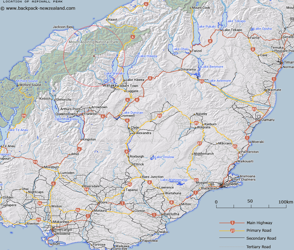
Map showing location of Aspinall Peak


LINZ description: Peak at head of Albert Burn and Matukituki River East Branch, south of Lois Peak.
Latitude: -44.31768
Longitude: 168.884474
Northing: 5084600
Easting: 1271800
Land District: Otago
Feat Type: Hill


Scroll down to see a more detailed road map and below that a topographical map showing the location of Aspinall Peak. The road map has been supplied by openstreetmap and the topographical map of Aspinall Peak has been supplied by Land Information New Zealand (LINZ).

Yes you can use the top static map for you school/university project or personal website with a link back. Contact me for any commercial use.

Aspinall Peak Map New Zealand


New Zealand places in our database
[ A ] [ B ] [ C ] [ D ] [ E ] [ F ] [ G ] [ H ] [ I ] [ J ] [ K ] [ L ] [ M ] [ N ] [ O ] [ P ] [ Q ] [ R ] [ S ] [ T ] [ U ] [ V ] [ W ] [ X ] [ Y ] [ Z ]


Closest 20 Hills to Aspinall Peak

Aspinall Peak ( 0km )   Lois Peak ( 0.9km )   Mount Twilight ( 2.27km )   Pickelhaube ( 4.13km )   Pickelhaube Peak ( 4.23km )   Mount Taurus ( 4.33km )   Mount Taunus ( 4.33km )   Mount Betsy Jane ( 5.79km )   Mount Betsey Jane ( 5.8km )   Glacier Dome ( 6.47km )   Mount Ragan ( 6.74km )   Mount Perseus ( 6.87km )   Stocking Peak ( 7.03km )   Sisyphus Peak ( 7.68km )   Fastness Peak ( 7.84km )   Mount Arne ( 8.05km )   Farrar Peak ( 8.83km )   Mount Vesta ( 8.94km )   Mount Jumbo ( 9.07km )   Mount Pollux ( 9.53km )   Canon Peak ( 9.6km )   Helena Peak ( 9.71km )   Mount Iphigenia ( 10.14km )   Dragonfly Peak ( 10.17km )   Mount Castor ( 10.74km )   Mount Juno ( 10.77km )   Corner Post ( 10.83km )   Apollo Peak ( 11.01km )   Munro Peak ( 11.42km )   Oblong Peak ( 11.47km )   Mount Aeolus ( 11.47km )   Moncrieff Peak ( 11.51km )   Moonraker ( 11.74km )   Spike ( 12.07km )   Mercury Peak ( 12.17km )   Aeroplane Peak ( 12.31km )   Pegasus Peak ( 12.35km )   Leda Peak ( 12.98km )   Flanagans Summit ( 13.01km )   Scylla and Charybdis ( 13.02km )