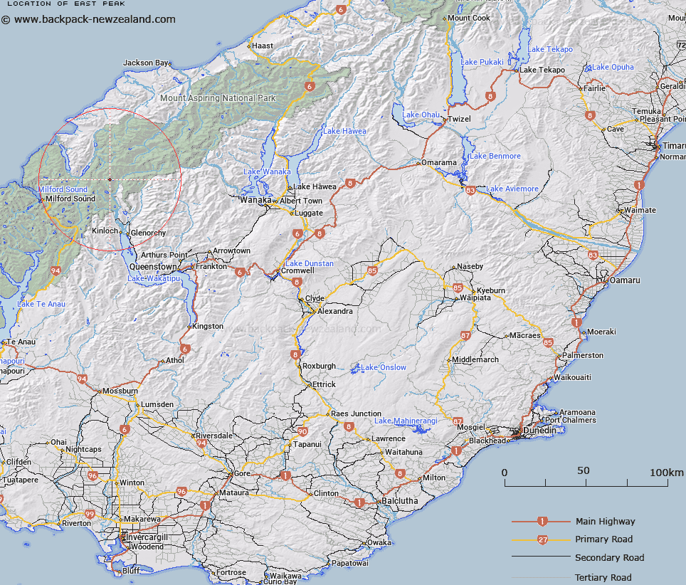
Map showing location of East Peak


LINZ description: On the Cosmos Range between Brideburn and Beansburn Rivers
Latitude: -44.569236
Longitude: 168.28997
Northing: 5054100
Easting: 1226000
Land District: Otago
Feat Type: Hill


Scroll down to see a more detailed road map and below that a topographical map showing the location of East Peak. The road map has been supplied by openstreetmap and the topographical map of East Peak has been supplied by Land Information New Zealand (LINZ).

Yes you can use the top static map for you school/university project or personal website with a link back. Contact me for any commercial use.

East Peak Map New Zealand


New Zealand places in our database
[ A ] [ B ] [ C ] [ D ] [ E ] [ F ] [ G ] [ H ] [ I ] [ J ] [ K ] [ L ] [ M ] [ N ] [ O ] [ P ] [ Q ] [ R ] [ S ] [ T ] [ U ] [ V ] [ W ] [ X ] [ Y ] [ Z ]


Closest 20 Hills to East Peak

West Peak ( 0.6km )   Sarpedon ( 4.2km )   Niobe Peak ( 4.23km )   Poseidon Peak ( 4.57km )   Mount Chaos ( 5.08km )   Tantalus Peak ( 5.1km )   Fohn Peak ( 5.53km )   McBride Peaks ( 5.62km )   Bride Peaks ( 5.62km )   Amphion Peak ( 6.07km )   Fiery Peak ( 6.16km )   Brenda Peak ( 6.25km )   Corinna Peak ( 6.42km )   Minos Peak ( 6.65km )   Sunset Peak ( 6.74km )   Mallory Peak ( 7.84km )   Irvine Peak ( 7.92km )   Cerberus ( 7.98km )   Mount Cerberus ( 7.99km )   Mount Nox ( 8.04km )   Barrington Peak ( 8.04km )   Welshman Peak ( 8.07km )   Terminal Peak ( 8.12km )   Hedin Peak ( 8.15km )   Frenchman Peak ( 8.38km )   Albert Peak ( 8.72km )   Courtenay Peak ( 8.74km )   Betty Peak ( 8.78km )   Pluto Peak ( 9.18km )   Head Peak ( 9.35km )   Sir William Peak ( 9.42km )   Gino Peak ( 9.52km )   Stefansson Peak ( 10.12km )   Watkins ( 10.17km )   West Peak ( 10.44km )   Mount Earnslaw/Pikirakatahi ( 10.45km )   Mount Earnslaw ( 10.45km )   O'Leary Peak ( 10.66km )   Leary Peak ( 10.66km )   Johansen Peak ( 10.87km )