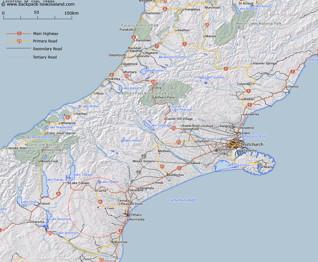
Map showing location of Coal Creek


LINZ description: Stream which flows into the Tengawai River approximately 5km north west of Cave.
Latitude: -44.304313
Longitude: 170.861291
Northing: 5092102.5
Easting: 1429408.8
Land District: Canterbury
Feat Type: Stream


Scroll down to see a more detailed road map and below that a topographical map showing the location of Coal Creek. The road map has been supplied by openstreetmap and the topographical map of Coal Creek has been supplied by Land Information New Zealand (LINZ).

Yes you can use the top static map for you school/university project or personal website with a link back. Contact me for any commercial use.

Coal Creek Map New Zealand


New Zealand places in our database
[ A ] [ B ] [ C ] [ D ] [ E ] [ F ] [ G ] [ H ] [ I ] [ J ] [ K ] [ L ] [ M ] [ N ] [ O ] [ P ] [ Q ] [ R ] [ S ] [ T ] [ U ] [ V ] [ W ] [ X ] [ Y ] [ Z ]


Closest 20 Streams to Coal Creek

Nelson Stream ( 3.36km )   Luscombe Stream ( 4.43km )   Blue Duck Stream ( 5.51km )   Cannington Stream ( 5.8km )   Tengawai River ( 6.05km )   Rocky Gully River ( 6.51km )   Tengawai Flat Creek ( 7.67km )   Mathias Stream ( 8.19km )   Chamberlain Stream ( 8.93km )   Emerald Stream ( 9.15km )   Burnett Stream ( 9.32km )   Blainslie Stream ( 9.65km )   Galway Stream ( 9.67km )   Sterndale Stream ( 10.16km )   Francis Stream ( 10.19km )   Opawa River ( 10.24km )   Matson Stream ( 10.87km )   Delamain Stream ( 11.2km )   Robinsons Road Creek ( 11.89km )   Totara Creek ( 11.99km )   White Rock River ( 12.92km )   Little Opawa River ( 13.5km )   Nimrod Stream ( 14.31km )   Pratt Stream ( 14.48km )   Sutherlands Creek ( 14.63km )   Massack Stream ( 15.15km )   Marsack Stream ( 15.15km )   Exe Stream ( 15.52km )   Tiako Stream ( 15.57km )   Kennaway Stream ( 15.69km )   Nessing Stream ( 15.73km )   Elworthy Stream ( 16.94km )   Pareora River ( 16.94km )   Trap Stream ( 17.21km )   Two Legged Stream ( 17.36km )   Opihi River ( 17.57km )   Taiko Stream ( 17.6km )   Maungati Stream ( 17.67km )   Hakataramea River ( 17.68km )   Motukaika River ( 17.84km )