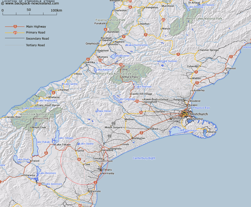
Map showing location of Sterndale Stream


LINZ description: Stream rising near Trig. F (Geodetic Code AAPF), flowing North-eastwards alongside Sterndale Valley Road and joining Totara Stream 1km North-east of Totara Valley locality. Opawa and Pareora Survey Districts.
Latitude: -44.258711
Longitude: 170.971923
Northing: 5097392
Easting: 1438108
Land District: Canterbury
Feat Type: Stream


Scroll down to see a more detailed road map and below that a topographical map showing the location of Sterndale Stream. The road map has been supplied by openstreetmap and the topographical map of Sterndale Stream has been supplied by Land Information New Zealand (LINZ).

Yes you can use the top static map for you school/university project or personal website with a link back. Contact me for any commercial use.

Sterndale Stream Map New Zealand


New Zealand places in our database
[ A ] [ B ] [ C ] [ D ] [ E ] [ F ] [ G ] [ H ] [ I ] [ J ] [ K ] [ L ] [ M ] [ N ] [ O ] [ P ] [ Q ] [ R ] [ S ] [ T ] [ U ] [ V ] [ W ] [ X ] [ Y ] [ Z ]


Closest 20 Streams to Sterndale Stream

Totara Creek ( 1.84km )   Tengawai Flat Creek ( 4km )   Robinsons Road Creek ( 5.67km )   Tengawai River ( 5.68km )   Nelson Stream ( 6.95km )   Sutherlands Creek ( 7.43km )   Rocky Gully River ( 8.19km )   Luscombe Stream ( 8.21km )   Opihi River ( 8.73km )   Emerald Stream ( 9.31km )   Burnett Stream ( 9.5km )   German Creek ( 9.77km )   Mawaro Creek ( 10.16km )   Coal Creek ( 10.16km )   Tiako Stream ( 10.53km )   Cannington Stream ( 11.64km )   Papaka Stream ( 12.58km )   Pleasant Point Stream ( 13.89km )   Galway Stream ( 14.25km )   Connells Creek ( 14.75km )   Mathias Stream ( 14.89km )   Raincliff Stream ( 15.12km )   Blue Duck Stream ( 15.21km )   Waitawa Creek ( 15.26km )   Kakahu River ( 15.68km )   Taiko Stream ( 15.85km )   Chamberlain Stream ( 15.87km )   Pareora River ( 15.9km )   Rosewill Stream ( 16.39km )   Pratt Stream ( 16.45km )   Stony Creek ( 16.56km )   Blainslie Stream ( 16.76km )   Delamain Stream ( 17.73km )   Francis Stream ( 18.6km )   Waiakeake Stream ( 19.01km )   Strathconan Creek ( 19.1km )   White Rock River ( 19.29km )   Rangatira Creek ( 19.31km )   Oakwood Stream ( 19.32km )   Borrell Creek ( 19.47km )