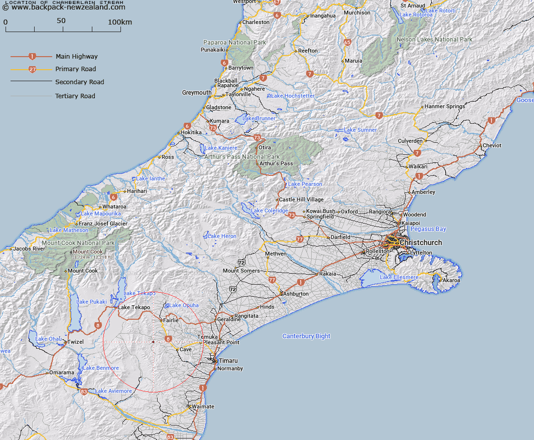
Map showing location of Chamberlain Stream


LINZ description: Stream rising 2.2km East by North-east of Trig. V (Geodetic Code AMHT), flowing North-eastwards along Chamberlain Road and joining Opawa River near Inchgowan homestead. Opawa Survey District.
Latitude: -44.254928
Longitude: 170.772783
Northing: 5097400
Easting: 1422200
Land District: Canterbury
Feat Type: Stream


Scroll down to see a more detailed road map and below that a topographical map showing the location of Chamberlain Stream. The road map has been supplied by openstreetmap and the topographical map of Chamberlain Stream has been supplied by Land Information New Zealand (LINZ).

Yes you can use the top static map for you school/university project or personal website with a link back. Contact me for any commercial use.

Chamberlain Stream Map New Zealand


New Zealand places in our database
[ A ] [ B ] [ C ] [ D ] [ E ] [ F ] [ G ] [ H ] [ I ] [ J ] [ K ] [ L ] [ M ] [ N ] [ O ] [ P ] [ Q ] [ R ] [ S ] [ T ] [ U ] [ V ] [ W ] [ X ] [ Y ] [ Z ]


Closest 20 Streams to Chamberlain Stream

Blainslie Stream ( 0.89km )   Delamain Stream ( 2.27km )   Little Opawa River ( 4.58km )   Blue Duck Stream ( 5.76km )   Exe Stream ( 6.78km )   Opawa River ( 6.98km )   Luscombe Stream ( 7.75km )   Kennaway Stream ( 7.79km )   Rocky Gully River ( 7.85km )   Emerald Stream ( 8.33km )   Trap Stream ( 8.33km )   Coal Creek ( 8.93km )   Mawaro Creek ( 8.93km )   Tengawai River ( 10.19km )   Lockharts Stream ( 10.45km )   Hakataramea River ( 10.65km )   Nelson Stream ( 11.26km )   Tramway Stream ( 11.33km )   Marsack Stream ( 11.47km )   Massack Stream ( 11.47km )   Hayter Stream ( 11.57km )   Coal Stream ( 12.56km )   Avalanche Stream ( 13.88km )   Nessing Stream ( 13.95km )   Cannington Stream ( 14.48km )   Duck Stream ( 14.61km )   Tengawai Flat Creek ( 15.21km )   Matson Stream ( 15.61km )   Hawkey Stream ( 15.67km )   Hankey Stream ( 15.67km )   Longden Stream ( 15.7km )   Strathconan Creek ( 15.73km )   Sterndale Stream ( 15.87km )   Fett Stream ( 15.96km )   Mathias Stream ( 16.09km )   Francis Stream ( 16.2km )   Halls Stream ( 16.69km )   Two Legged Stream ( 16.85km )   MacGregor Stream ( 17.12km )   Dalgety Stream ( 17.15km )