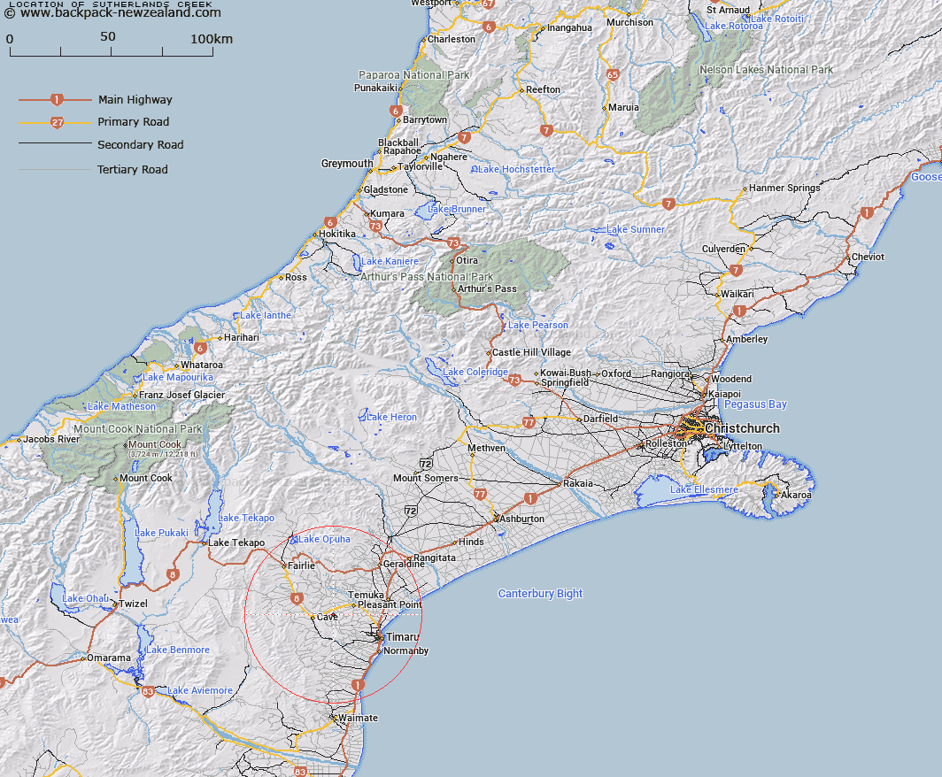
Map showing location of Sutherlands Creek


LINZ description: Creek that flows alongside Sutherlands Road to Number 8 State Highway where it is artificially drained into the Tengawai River. This area is known officially as the Sutherlands locality.
Latitude: -44.300156
Longitude: 171.045096
Northing: 5092930.2
Easting: 1444058.9
Land District: Canterbury
Feat Type: Stream


Scroll down to see a more detailed road map and below that a topographical map showing the location of Sutherlands Creek. The road map has been supplied by openstreetmap and the topographical map of Sutherlands Creek has been supplied by Land Information New Zealand (LINZ).

Yes you can use the top static map for you school/university project or personal website with a link back. Contact me for any commercial use.

Sutherlands Creek Map New Zealand


New Zealand places in our database
[ A ] [ B ] [ C ] [ D ] [ E ] [ F ] [ G ] [ H ] [ I ] [ J ] [ K ] [ L ] [ M ] [ N ] [ O ] [ P ] [ Q ] [ R ] [ S ] [ T ] [ U ] [ V ] [ W ] [ X ] [ Y ] [ Z ]


Closest 20 Streams to Sutherlands Creek

Robinsons Road Creek ( 2.75km )   Tiako Stream ( 3.78km )   German Creek ( 4.41km )   Papaka Stream ( 5.62km )   Tengawai Flat Creek ( 7.11km )   Totara Creek ( 7.17km )   Sterndale Stream ( 7.43km )   Burnett Stream ( 8.05km )   Rosewill Stream ( 9.15km )   Pleasant Point Stream ( 9.3km )   Waitawa Creek ( 9.41km )   Taiko Stream ( 10.08km )   Pareora River ( 10.58km )   Nelson Stream ( 11.4km )   Oakwood Stream ( 11.91km )   Connells Creek ( 12.19km )   Otipua Creek South Branch ( 12.35km )   Tengawai River ( 12.43km )   Otipua Creek North Branch ( 12.67km )   Cannington Stream ( 12.89km )   Pratt Stream ( 13.12km )   Opihi River ( 13.38km )   Galway Stream ( 13.49km )   Luscombe Stream ( 14.54km )   Coal Creek ( 14.63km )   Mawaro Creek ( 14.63km )   Washdyke Creek ( 14.73km )   Rocky Gully River ( 15.13km )   Waiakeake Stream ( 15.29km )   Mathias Stream ( 15.46km )   Taitarakihi Creek ( 15.53km )   Pig Hunting Creek ( 15.63km )   Raupo Creek ( 15.65km )   Emerald Stream ( 16.64km )   Kakahu River ( 16.95km )   Rangatira Creek ( 17.14km )   Elworthy Stream ( 18.14km )   White Rock River ( 18.61km )   Saltwater Creek ( 19.03km )   Temuka River ( 19.23km )