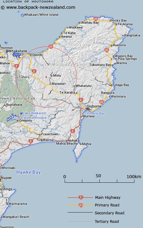
Map showing location of Moutohora
LINZ description: Trig Station 149 (Geodetic code B243) and peak at the headwaters of the Pakihi Stream, and a tributary of the Manganuku Stream, 5km West of Moutohora. Urutawa and Motu Survey Districts.
Latitude: -38.274563
Longitude: 177.484254
Northing: 5754200
Easting: 1992327
Land District: Gisborne
Feat Type: Trig Station
Latitude: -38.274563
Longitude: 177.484254
Northing: 5754200
Easting: 1992327
Land District: Gisborne
Feat Type: Trig Station

Scroll down to see a more detailed road map and below that a topographical map showing the location of Moutohora. The road map has been supplied by openstreetmap and the topographical map of Moutohora has been supplied by Land Information New Zealand (LINZ).
Yes you can use the top static map for you school/university project or personal website with a link back. Contact me for any commercial use.
[ A ] [ B ] [ C ] [ D ] [ E ] [ F ] [ G ] [ H ] [ I ] [ J ] [ K ] [ L ] [ M ] [ N ] [ O ] [ P ] [ Q ] [ R ] [ S ] [ T ] [ U ] [ V ] [ W ] [ X ] [ Y ] [ Z ]