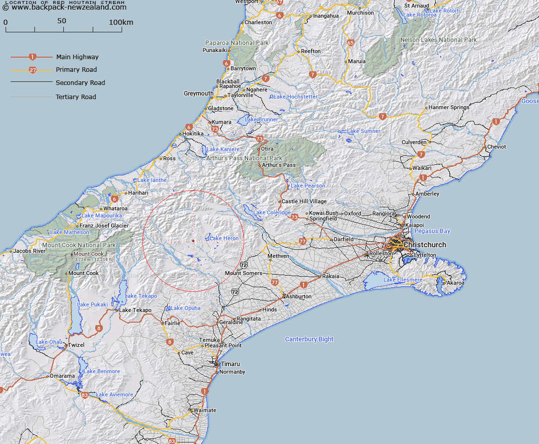
Map showing location of Red Moutain Stream


LINZ description: Right Bank tributary of South Branch Ashburton River rising 1.2km North by North-west of Red Mountain, flowing westward and joining South Branch Ashburton River 1.9km East of Trig. C (Geodetic Code AN5P). Blocks IX and X Heron Survey District
Latitude: -43.493894
Longitude: 171.062148
Northing: 5182512.6
Easting: 1443318.3
Land District: Canterbury
Feat Type: Stream


Scroll down to see a more detailed road map and below that a topographical map showing the location of Red Moutain Stream. The road map has been supplied by openstreetmap and the topographical map of Red Moutain Stream has been supplied by Land Information New Zealand (LINZ).

Yes you can use the top static map for you school/university project or personal website with a link back. Contact me for any commercial use.

Red Moutain Stream Map New Zealand


New Zealand places in our database
[ A ] [ B ] [ C ] [ D ] [ E ] [ F ] [ G ] [ H ] [ I ] [ J ] [ K ] [ L ] [ M ] [ N ] [ O ] [ P ] [ Q ] [ R ] [ S ] [ T ] [ U ] [ V ] [ W ] [ X ] [ Y ] [ Z ]


Closest 20 Streams to Red Moutain Stream

Sparrow Hawk Stream ( 3.03km )   Olliver Stream ( 5.33km )   Harding Stream ( 5.72km )   Triangle Stream ( 6.56km )   Dunbar Stream ( 7.72km )   Stumpy Stream ( 8.06km )   Kenneth Creek ( 8.55km )   Craddock Stream ( 8.61km )   Cradock Stream ( 8.61km )   Polhill Stream ( 8.64km )   Clent Hills Stream ( 9.4km )   Cameron River ( 9.63km )   Strone Stream ( 9.71km )   Powerhouse Stream ( 10km )   Paddle Hill Creek ( 10.02km )   Potts River ( 10.73km )   Lochiel Stream ( 10.81km )   Johnstone Stream ( 10.85km )   Swin River ( 11.31km )   Lawsley Stream ( 11.39km )   Gentleman Smith Stream ( 11.5km )   Jacobs Stream ( 12.7km )   Spean Stream ( 12.78km )   Emily Stream ( 12.9km )   Mellish Stream ( 13.41km )   Lochaber Stream ( 13.61km )   Whisky Stream ( 13.91km )   Haast Stream ( 14.14km )   Swin River South Branch ( 14.91km )   Lake Stream ( 14.91km )   Home Creek ( 14.93km )   Swin River North Branch ( 15.24km )   Caroline Stream ( 15.48km )   Potato Stream ( 15.68km )   Bush Creek ( 15.88km )   Balmacaan Stream ( 15.92km )   Shingly Stream ( 15.93km )   Lambies Stream ( 16.13km )   Emma Stream ( 16.23km )   Charlie Stream ( 16.23km )