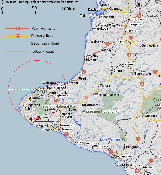
Map showing location of Tapuae Marine Reserve


LINZ description: The Taranaki coast is well known for its ruggedness and spectacular landforms, and the 1,404 ha Tapuae Marine Reserve covers a classic part of this scenery. The remains of an ancient volcano sit at the northern end of Tapuae Marine Reserve, visible as a series of islands and rocks (their steep sides continue deep down beneath the water). The southern part of the reserve is typical of the wild Taranaki coast – reef, mud and sand below, and black sand beaches above. Tapuae Marine Reserve adjoins the Ngā Motu/Sugar Loaf Island Marine Protected Area, south of New Plymouth.
Latitude: -39.074167
Longitude: 173.991111
Northing: 5674525.6
Easting: 1685733.3
Land District: Taranaki
Feat Type: Marine Reserve


Scroll down to see a more detailed road map and below that a topographical map showing the location of Tapuae Marine Reserve. The road map has been supplied by openstreetmap and the topographical map of Tapuae Marine Reserve has been supplied by Land Information New Zealand (LINZ).

Yes you can use the top static map for you school/university project or personal website with a link back. Contact me for any commercial use.

Tapuae Marine Reserve Map New Zealand


New Zealand places in our database
[ A ] [ B ] [ C ] [ D ] [ E ] [ F ] [ G ] [ H ] [ I ] [ J ] [ K ] [ L ] [ M ] [ N ] [ O ] [ P ] [ Q ] [ R ] [ S ] [ T ] [ U ] [ V ] [ W ] [ X ] [ Y ] [ Z ]


Closest 20 Marine Reserves to Tapuae Marine Reserve

Parininihi Marine Reserve ( 51.34km )   Westhaven (Te Tai Tapu) Marine Reserve ( 212km )   Kapiti Marine Reserve ( 214.36km )   Tonga Island Marine Reserve ( 215.65km )   Long Island - Kokomohua Marine Reserve ( 228.23km )   Horoirangi Marine Reserve ( 238.04km )   Motu Manawa-Pollen Island Marine Reserve ( 253.17km )   Taputeranga Marine Reserve ( 262.2km )   Kahurangi Marine Reserve ( 268km )   Te Matuku Marine Reserve ( 269.64km )   Te Angiangi Marine Reserve ( 272.99km )   Long Bay-Okura Marine Reserve ( 275.29km )   Tuhua (Mayor Island) Marine Reserve ( 282.83km )   Whanganui A Hei (Cathedral Cove) Marine Reserve ( 296.27km )   T?wharanui Marine Reserve ( 310.73km )   Cape Rodney-Okakari Point Marine Reserve ( 320.27km )   Te Paepae o Aotea (Volkner Rocks) Marine Reserve ( 326.73km )   Whangarei Harbour Marine Reserve ( 369.55km )   Te Tapuwae o Rongokako Marine Reserve ( 369.89km )   Hikurangi Marine Reserve ( 378.9km )   Poor Knights Islands Marine Reserve ( 403.44km )   Punakaiki Marine Reserve ( 408.42km )   Pohatu Marine Reserve ( 540.17km )   Akaroa Marine Reserve ( 541.31km )   Waiau Glacier Coast Marine Reserve ( 568.84km )   Tauparik?k? Marine Reserve ( 658.81km )   Hautai Marine Reserve ( 751.53km )   Piopiotahi (Milford Sound) Marine Reserve ( 797.69km )   Te Hapua (Sutherland Sound) Marine Reserve ( 822.9km )   Hawea (Clio Rocks) Marine Reserve ( 832.29km )   Kahukura (Gold Arm) Marine Reserve ( 878.11km )   Kutu Parera (Gaer Arm) Marine Reserve ( 891.82km )   Te Awaatu Channel (The Gut) Marine Reserve ( 902.25km )   Taipari Roa (Elizabeth Island) Marine Reserve ( 904.09km )   Moana Uta (West Jacket Arm) Marine Reserve ( 936.84km )   Taumoana (Five Finger Peninsula) Marine Reserve ( 956.68km )   Te Tapuwae o Hua (Long Sound) Marine Reserve ( 969.13km )   Ulva Island - Te Wharawhara Marine Reserve ( 996.26km )