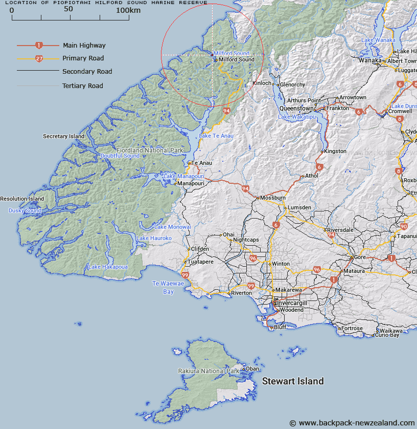
Map showing location of Piopiotahi (Milford Sound) Marine Reserve


LINZ description: The reserve covers an area of 690 hectares along the northern side of Milford Sound, from the head of the Sound to Dale Point.
Latitude: -44.632778
Longitude: 167.893333
Northing: 5045143.2
Easting: 1194946.8
Land District: Southland
Feat Type: Marine Reserve


Scroll down to see a more detailed road map and below that a topographical map showing the location of Piopiotahi (Milford Sound) Marine Reserve. The road map has been supplied by openstreetmap and the topographical map of Piopiotahi (Milford Sound) Marine Reserve has been supplied by Land Information New Zealand (LINZ).

Yes you can use the top static map for you school/university project or personal website with a link back. Contact me for any commercial use.

Piopiotahi (Milford Sound) Marine Reserve Map New Zealand


New Zealand places in our database
[ A ] [ B ] [ C ] [ D ] [ E ] [ F ] [ G ] [ H ] [ I ] [ J ] [ K ] [ L ] [ M ] [ N ] [ O ] [ P ] [ Q ] [ R ] [ S ] [ T ] [ U ] [ V ] [ W ] [ X ] [ Y ] [ Z ]


Closest 20 Marine Reserves to Piopiotahi (Milford Sound) Marine Reserve

Te Hapua (Sutherland Sound) Marine Reserve ( 26.13km )   Hawea (Clio Rocks) Marine Reserve ( 35.49km )   Hautai Marine Reserve ( 49.2km )   Kahukura (Gold Arm) Marine Reserve ( 80.74km )   Kutu Parera (Gaer Arm) Marine Reserve ( 94.34km )   Te Awaatu Channel (The Gut) Marine Reserve ( 104.73km )   Taipari Roa (Elizabeth Island) Marine Reserve ( 107.16km )   Tauparik?k? Marine Reserve ( 139.48km )   Moana Uta (West Jacket Arm) Marine Reserve ( 139.68km )   Taumoana (Five Finger Peninsula) Marine Reserve ( 158.99km )   Te Tapuwae o Hua (Long Sound) Marine Reserve ( 174.78km )   Waiau Glacier Coast Marine Reserve ( 232.1km )   Ulva Island - Te Wharawhara Marine Reserve ( 257.19km )   Punakaiki Marine Reserve ( 391.69km )   Akaroa Marine Reserve ( 412.2km )   Pohatu Marine Reserve ( 416.88km )   Hikurangi Marine Reserve ( 515.66km )   Kahurangi Marine Reserve ( 529.7km )   Westhaven (Te Tai Tapu) Marine Reserve ( 585.83km )   Horoirangi Marine Reserve ( 590.01km )   Tonga Island Marine Reserve ( 593.68km )   Long Island - Kokomohua Marine Reserve ( 651.27km )   Taputeranga Marine Reserve ( 666.98km )   Kapiti Marine Reserve ( 712.58km )   Tapuae Marine Reserve ( 797.69km )   Parininihi Marine Reserve ( 844.23km )   Te Angiangi Marine Reserve ( 887.18km )   Motu Manawa-Pollen Island Marine Reserve ( 1034.96km )   Long Bay-Okura Marine Reserve ( 1056.46km )   Te Matuku Marine Reserve ( 1060.47km )   Tuhua (Mayor Island) Marine Reserve ( 1078.48km )   Te Tapuwae o Rongokako Marine Reserve ( 1087.58km )   T?wharanui Marine Reserve ( 1090.43km )   Whanganui A Hei (Cathedral Cove) Marine Reserve ( 1093.29km )   Cape Rodney-Okakari Point Marine Reserve ( 1097.58km )   Te Paepae o Aotea (Volkner Rocks) Marine Reserve ( 1109.19km )   Whangarei Harbour Marine Reserve ( 1128.61km )   Poor Knights Islands Marine Reserve ( 1170km )