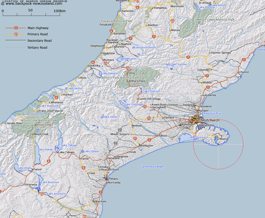
Map showing location of Akaroa Marine Reserve


LINZ description: Located at the entrance to Akaroa Harbour. It lies between Gateway Point and Elephant Head and between the eastern shore and Wainui Leading Lights line. It is approximately 4 km long, and varies in width between approximately 0.4 km and 1.8 km. The marine reserve lies alongside an area known as Dan Rogers Bluff (an unofficial name and not recorded on official maps/charts), with spectacular volcanic cliffs, sea caves and sea stacks. The underwater topography is spectacular, with the cliffs and bluffs falling vertically to the seabed. These are colonised by marine communities in interesting zonation patterns. Huge room-sized boulders provide spectacular underwater scenery and habitat for marine communities of Banks Peninsula.
Latitude: -43.881076
Longitude: 172.962594
Northing: 5141335
Easting: 1596995
Land District: Canterbury
Feat Type: Marine Reserve


Scroll down to see a more detailed road map and below that a topographical map showing the location of Akaroa Marine Reserve. The road map has been supplied by openstreetmap and the topographical map of Akaroa Marine Reserve has been supplied by Land Information New Zealand (LINZ).

Yes you can use the top static map for you school/university project or personal website with a link back. Contact me for any commercial use.

Akaroa Marine Reserve Map New Zealand


New Zealand places in our database
[ A ] [ B ] [ C ] [ D ] [ E ] [ F ] [ G ] [ H ] [ I ] [ J ] [ K ] [ L ] [ M ] [ N ] [ O ] [ P ] [ Q ] [ R ] [ S ] [ T ] [ U ] [ V ] [ W ] [ X ] [ Y ] [ Z ]


Closest 20 Marine Reserves to Akaroa Marine Reserve

Pohatu Marine Reserve ( 4.73km )   Hikurangi Marine Reserve ( 164.51km )   Punakaiki Marine Reserve ( 236.99km )   Waiau Glacier Coast Marine Reserve ( 243.2km )   Horoirangi Marine Reserve ( 304.16km )   Tauparik?k? Marine Reserve ( 306.51km )   Taputeranga Marine Reserve ( 317.21km )   Long Island - Kokomohua Marine Reserve ( 326.27km )   Kahurangi Marine Reserve ( 330.11km )   Tonga Island Marine Reserve ( 333.73km )   Westhaven (Te Tai Tapu) Marine Reserve ( 364.64km )   Kapiti Marine Reserve ( 373.84km )   Hautai Marine Reserve ( 388.65km )   Piopiotahi (Milford Sound) Marine Reserve ( 412.2km )   Te Hapua (Sutherland Sound) Marine Reserve ( 436.34km )   Hawea (Clio Rocks) Marine Reserve ( 444.46km )   Kahukura (Gold Arm) Marine Reserve ( 481.69km )   Kutu Parera (Gaer Arm) Marine Reserve ( 485.66km )   Taipari Roa (Elizabeth Island) Marine Reserve ( 492.67km )   Te Awaatu Channel (The Gut) Marine Reserve ( 501.38km )   Ulva Island - Te Wharawhara Marine Reserve ( 509.04km )   Moana Uta (West Jacket Arm) Marine Reserve ( 521.58km )   Te Angiangi Marine Reserve ( 523.78km )   Te Tapuwae o Hua (Long Sound) Marine Reserve ( 539.33km )   Tapuae Marine Reserve ( 541.31km )   Taumoana (Five Finger Peninsula) Marine Reserve ( 545.41km )   Parininihi Marine Reserve ( 572.84km )   Te Tapuwae o Rongokako Marine Reserve ( 732.67km )   Tuhua (Mayor Island) Marine Reserve ( 786.85km )   Motu Manawa-Pollen Island Marine Reserve ( 793.79km )   Te Paepae o Aotea (Volkner Rocks) Marine Reserve ( 793.99km )   Te Matuku Marine Reserve ( 805.95km )   Long Bay-Okura Marine Reserve ( 815.79km )   Whanganui A Hei (Cathedral Cove) Marine Reserve ( 820.89km )   T?wharanui Marine Reserve ( 851.15km )   Cape Rodney-Okakari Point Marine Reserve ( 861.03km )   Whangarei Harbour Marine Reserve ( 910.49km )   Poor Knights Islands Marine Reserve ( 944.73km )