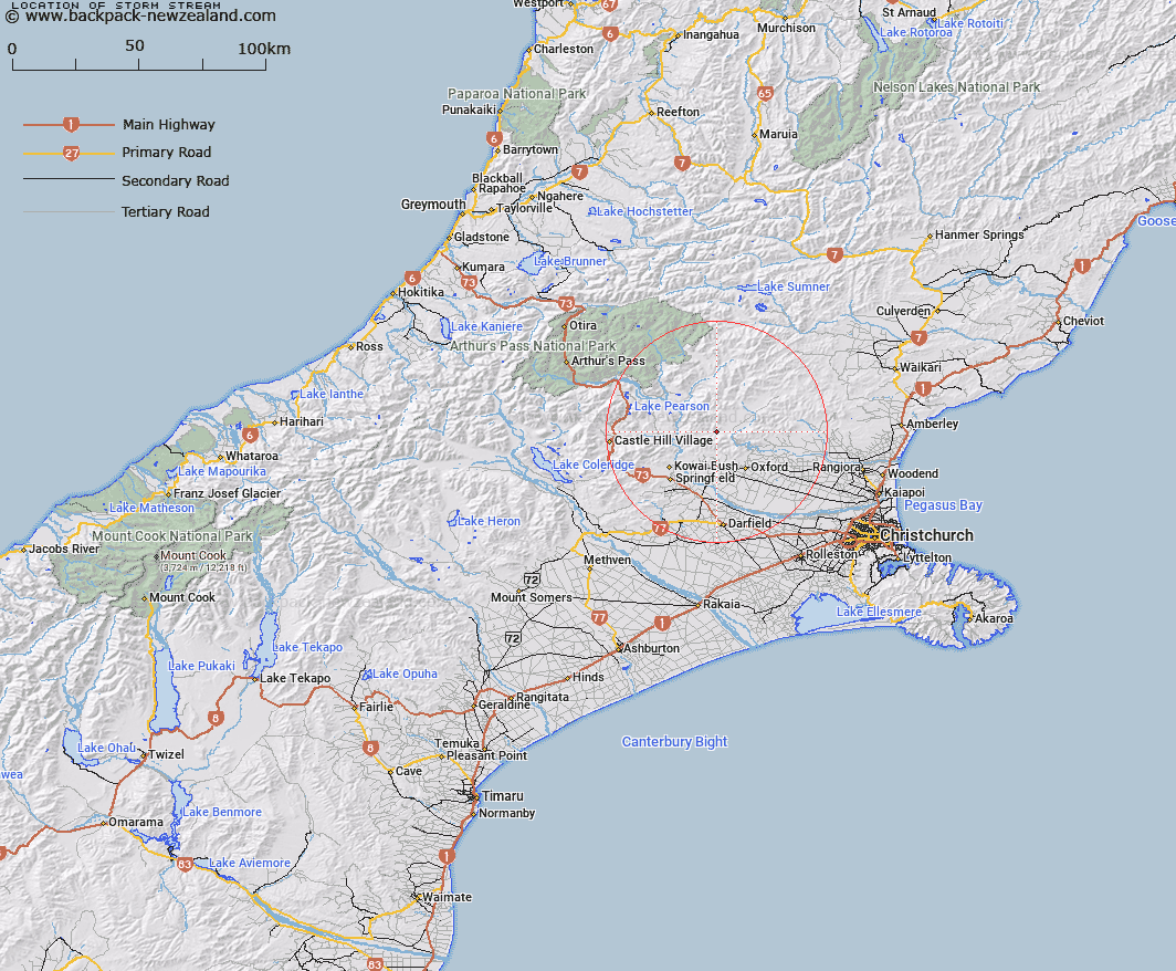
Map showing location of Storm Stream


LINZ description: Gully between Whistler and Townshend Rivers. Rises about 1mile south of Mt Storm and flows south into Townshend River.
Latitude: -43.176856
Longitude: 172.089843
Northing: 5219143.3
Easting: 1526027.6
Land District: Canterbury
Feat Type: Stream


Scroll down to see a more detailed road map and below that a topographical map showing the location of Storm Stream. The road map has been supplied by openstreetmap and the topographical map of Storm Stream has been supplied by Land Information New Zealand (LINZ).

Yes you can use the top static map for you school/university project or personal website with a link back. Contact me for any commercial use.

Storm Stream Map New Zealand


New Zealand places in our database
[ A ] [ B ] [ C ] [ D ] [ E ] [ F ] [ G ] [ H ] [ I ] [ J ] [ K ] [ L ] [ M ] [ N ] [ O ] [ P ] [ Q ] [ R ] [ S ] [ T ] [ U ] [ V ] [ W ] [ X ] [ Y ] [ Z ]


Closest 20 Streams to Storm Stream

Harman Stream ( 1.94km )   Shifton Stream ( 2.02km )   Millton Stream ( 3.14km )   Moody Stream ( 3.57km )   Five Gully Stream ( 3.65km )   Milton Stream ( 3.84km )   Keats Stream ( 4.38km )   Townshend River ( 5.13km )   Snowdale Stream ( 5.57km )   Dobson Stream ( 5.65km )   Oxford Creek ( 6.39km )   East Branch Coopers Creek ( 7.19km )   Mannering Stream ( 7.23km )   Big Ben Stream ( 7.43km )   Dog Leg Stream ( 7.5km )   Cunningham Stream ( 7.99km )   West Branch Coopers Creek ( 8.36km )   Cascade Stream ( 8.55km )   Kingsdown Stream ( 8.62km )   Chest Peak Stream ( 8.8km )   Broom Stream ( 9.08km )   Ladbrook Stream ( 9.3km )   Dorman Stream ( 9.4km )   Salmon Creek ( 9.57km )   Billy Stream ( 9.57km )   Wharfedale Stream ( 10.01km )   Coal Creek ( 10.04km )   Richardson Stream ( 10.26km )   Canary Stream ( 10.27km )   Foster Stream ( 10.29km )   Whistler River ( 10.45km )   White Stream ( 11.24km )   Eyre River ( 11.39km )   Boundary Stream ( 11.64km )   Washpen Stream ( 11.72km )   Mounseys Stream ( 11.72km )   Kinnebrooks Stream ( 11.73km )   Ribbonwood Stream ( 12.08km )   Glentui River ( 12.59km )   Coopers Creek ( 12.64km )