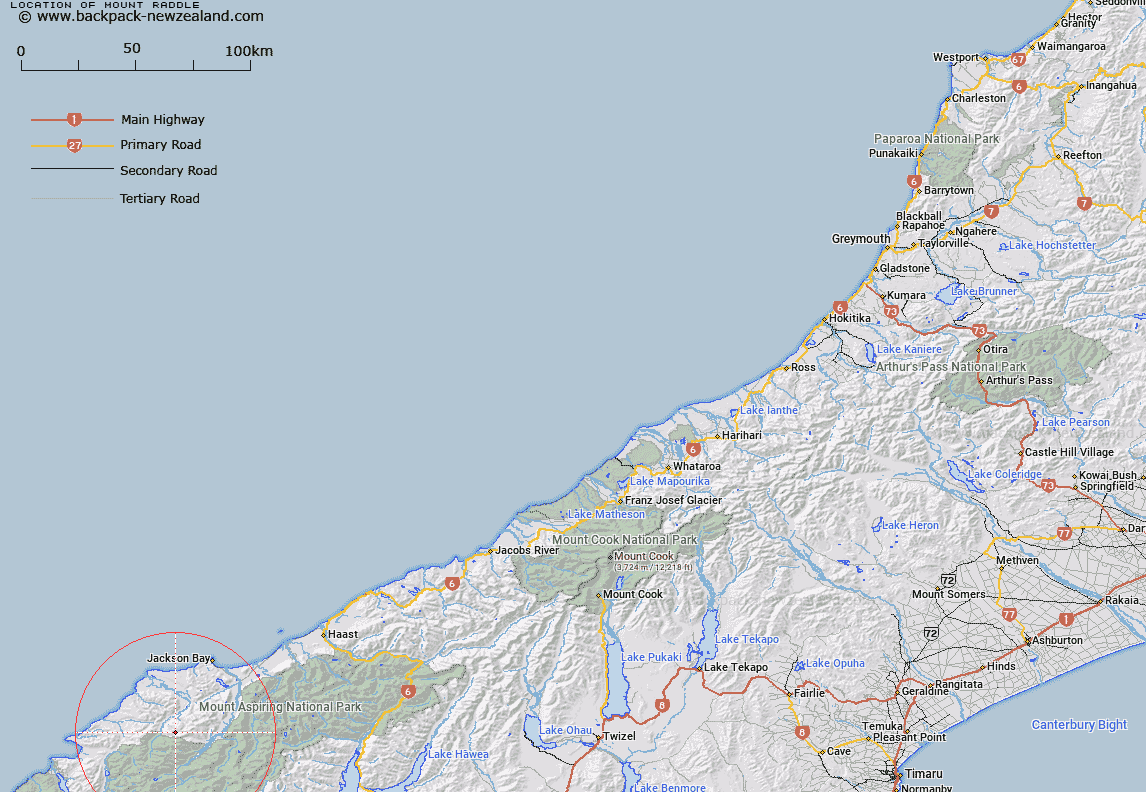
Map showing location of Mount Raddle


LINZ description: Peak situated between Falls Creek and McKay Creek
Latitude: -44.237669
Longitude: 168.470881
Northing: 5091746
Easting: 1238324.2
Land District: Westland
Feat Type: Hill


Scroll down to see a more detailed road map and below that a topographical map showing the location of Mount Raddle. The road map has been supplied by openstreetmap and the topographical map of Mount Raddle has been supplied by Land Information New Zealand (LINZ).

Yes you can use the top static map for you school/university project or personal website with a link back. Contact me for any commercial use.

Mount Raddle Map New Zealand


New Zealand places in our database
[ A ] [ B ] [ C ] [ D ] [ E ] [ F ] [ G ] [ H ] [ I ] [ J ] [ K ] [ L ] [ M ] [ N ] [ O ] [ P ] [ Q ] [ R ] [ S ] [ T ] [ U ] [ V ] [ W ] [ X ] [ Y ] [ Z ]


Closest 20 Hills to Mount Raddle

Bald Mountain ( 3.08km )   Richards Mountain ( 3.16km )   Mount Richards ( 3.17km )   Riddle Peak ( 3.2km )   Tararua Peak ( 5.12km )   Joe Peak ( 5.89km )   Martyr Hill ( 8.06km )   Staircase Mountain ( 8.07km )   Alfred Peak ( 8.52km )   Mount Theta ( 9.21km )   Remote Peaks ( 9.33km )   Redoubt Peaks ( 9.94km )   Mount Delta ( 10.43km )   Junction Hill ( 10.97km )   Retreat Peaks ( 12.29km )   Collyer ( 12.33km )   Distal ( 12.4km )   Dagon ( 12.83km )   Mount Eggelling ( 13.15km )   Mount Eggeling ( 13.15km )   Telescope Hill ( 13.52km )   Red Mountain ( 13.63km )   Toreador Peak ( 14.6km )   Matador ( 14.75km )   Picador ( 15.09km )   Charlies Bump ( 15.18km )   Typhoon Peak ( 15.23km )   Tempest Peak ( 15.44km )   Dee Hill ( 15.54km )   The Pommel ( 16.01km )   Holloway Peak ( 16.09km )   Snowden ( 16.19km )   Mount Caria ( 16.24km )   Cilicia Peak ( 16.38km )   Mount Temple ( 16.45km )   Turks Head ( 16.58km )   Eros ( 16.68km )   Trinity ( 16.97km )   Mount Lindsay ( 17.14km )   Tyler ( 17.2km )