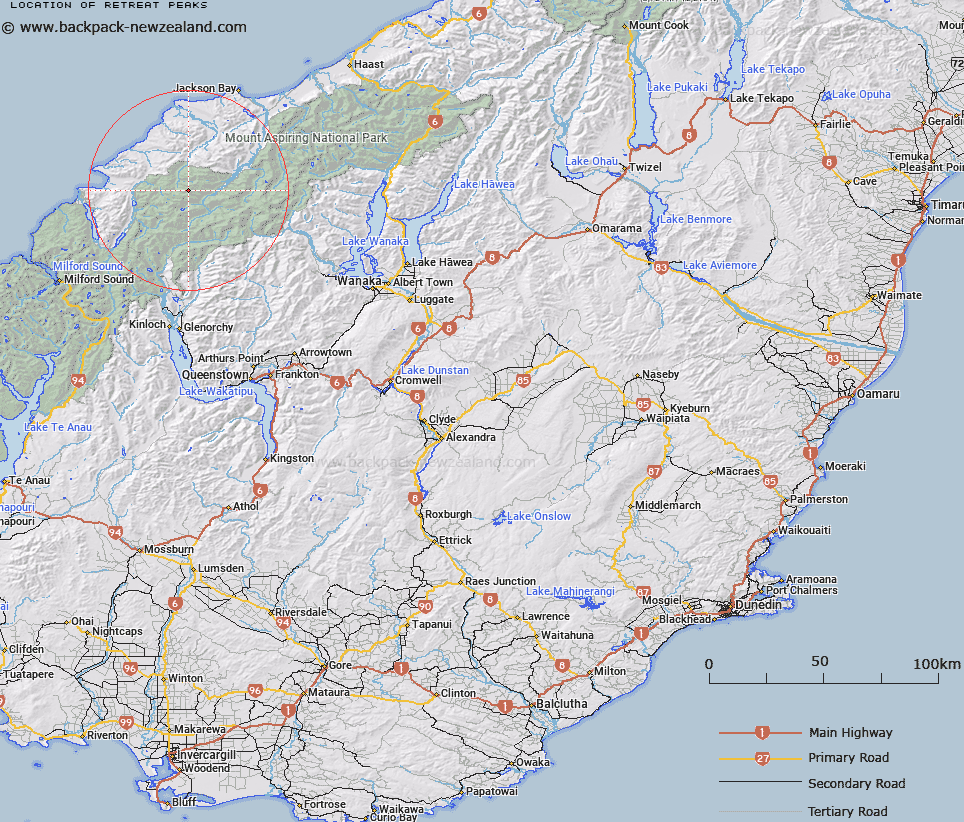
Map showing location of Retreat Peaks


LINZ description: Five peaks close together north of Toreador and lying on a ridge which starts on the east side of Tornado Neve
Latitude: -44.342323
Longitude: 168.421114
Northing: 5079900
Easting: 1235000
Land District: Otago
Feat Type: Hill


Scroll down to see a more detailed road map and below that a topographical map showing the location of Retreat Peaks. The road map has been supplied by openstreetmap and the topographical map of Retreat Peaks has been supplied by Land Information New Zealand (LINZ).

Yes you can use the top static map for you school/university project or personal website with a link back. Contact me for any commercial use.

Retreat Peaks Map New Zealand


New Zealand places in our database
[ A ] [ B ] [ C ] [ D ] [ E ] [ F ] [ G ] [ H ] [ I ] [ J ] [ K ] [ L ] [ M ] [ N ] [ O ] [ P ] [ Q ] [ R ] [ S ] [ T ] [ U ] [ V ] [ W ] [ X ] [ Y ] [ Z ]


Closest 20 Hills to Retreat Peaks

Toreador Peak ( 2.31km )   Redoubt Peaks ( 2.41km )   Matador ( 2.73km )   Typhoon Peak ( 2.94km )   Tempest Peak ( 3.17km )   Remote Peaks ( 3.27km )   Picador ( 3.51km )   Holloway Peak ( 3.79km )   Mount Temple ( 4.16km )   Trinity ( 4.8km )   Farrell Peak ( 5.49km )   Alfred Peak ( 6.22km )   Red Mountain ( 6.51km )   Gyrae ( 7.01km )   Camp Oven Dome ( 7.82km )   Five Fingers ( 8.01km )   Darkness Peak ( 8.14km )   Pyramid ( 8.53km )   Cilicia Peak ( 8.61km )   Futurity Rock ( 8.77km )   Elespie ( 8.99km )   Mount Caria ( 9.04km )   Pic d'argent ( 9.11km )   Joe Peak ( 9.13km )   Little Ark ( 9.3km )   Gable Peak ( 9.38km )   Buttress ( 9.71km )   Ark ( 9.74km )   The Tower ( 10.2km )   Beacon ( 10.5km )   Little Red Hill ( 10.79km )   Telescope Hill ( 11.13km )   Battlement Peak ( 11.14km )   Allison Mountain ( 11.33km )   Passchendaele Peak ( 11.39km )   Turks Head ( 11.57km )   Bald Mountain ( 11.93km )   Annetta Mountain ( 12.22km )   Mount Raddle ( 12.29km )   Daedelus ( 12.46km )