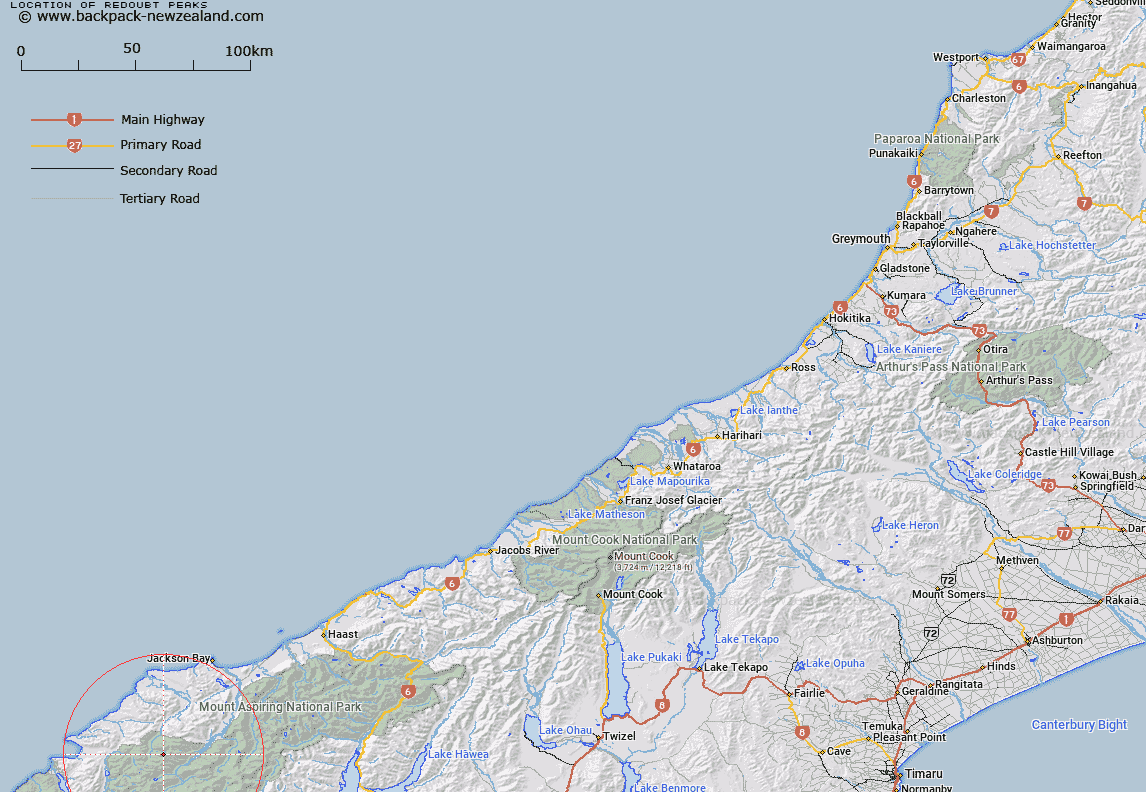
Map showing location of Redoubt Peaks


LINZ description: On the same ridge as the Remote Peaks, and lying due west
Latitude: -44.320885
Longitude: 168.425294
Northing: 5082300
Easting: 1235200
Land District: Westland
Feat Type: Hill


Scroll down to see a more detailed road map and below that a topographical map showing the location of Redoubt Peaks. The road map has been supplied by openstreetmap and the topographical map of Redoubt Peaks has been supplied by Land Information New Zealand (LINZ).

Yes you can use the top static map for you school/university project or personal website with a link back. Contact me for any commercial use.

Redoubt Peaks Map New Zealand


New Zealand places in our database
[ A ] [ B ] [ C ] [ D ] [ E ] [ F ] [ G ] [ H ] [ I ] [ J ] [ K ] [ L ] [ M ] [ N ] [ O ] [ P ] [ Q ] [ R ] [ S ] [ T ] [ U ] [ V ] [ W ] [ X ] [ Y ] [ Z ]


Closest 20 Hills to Redoubt Peaks

Remote Peaks ( 1.8km )   Retreat Peaks ( 2.41km )   Toreador Peak ( 4.68km )   Matador ( 4.84km )   Alfred Peak ( 5.05km )   Typhoon Peak ( 5.31km )   Picador ( 5.32km )   Tempest Peak ( 5.5km )   Holloway Peak ( 6.18km )   Red Mountain ( 6.38km )   Mount Temple ( 6.54km )   Trinity ( 7.04km )   Joe Peak ( 7.38km )   Farrell Peak ( 7.64km )   Gyrae ( 9.19km )   Cilicia Peak ( 9.79km )   Bald Mountain ( 9.81km )   Mount Raddle ( 9.94km )   Camp Oven Dome ( 10.07km )   Mount Caria ( 10.08km )   Telescope Hill ( 10.12km )   Five Fingers ( 10.12km )   Darkness Peak ( 10.28km )   Elespie ( 10.71km )   Pyramid ( 10.9km )   Beacon ( 11.08km )   Futurity Rock ( 11.15km )   Pic d'argent ( 11.28km )   Little Ark ( 11.58km )   Gable Peak ( 11.79km )   Ark ( 11.98km )   Little Red Hill ( 12.06km )   Battlement Peak ( 12.09km )   Buttress ( 12.11km )   Turks Head ( 12.17km )   Allison Mountain ( 12.35km )   The Tower ( 12.51km )   Junction Hill ( 12.52km )   Richards Mountain ( 12.64km )   Mount Richards ( 12.64km )