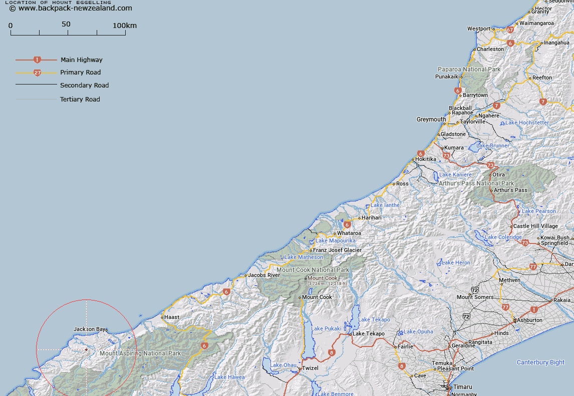
Map showing location of Mount Eggelling


LINZ description: Mountain at height 1136m, located above Cascade River in south Westland
Latitude: -44.119609
Longitude: 168.461333
Northing: 5104818.1
Easting: 1236836.2
Land District: Westland
Feat Type: Hill


Scroll down to see a more detailed road map and below that a topographical map showing the location of Mount Eggelling. The road map has been supplied by openstreetmap and the topographical map of Mount Eggelling has been supplied by Land Information New Zealand (LINZ).

Yes you can use the top static map for you school/university project or personal website with a link back. Contact me for any commercial use.

Mount Eggelling Map New Zealand


New Zealand places in our database
[ A ] [ B ] [ C ] [ D ] [ E ] [ F ] [ G ] [ H ] [ I ] [ J ] [ K ] [ L ] [ M ] [ N ] [ O ] [ P ] [ Q ] [ R ] [ S ] [ T ] [ U ] [ V ] [ W ] [ X ] [ Y ] [ Z ]


Closest 20 Hills to Mount Eggelling

Mount Delta ( 2.91km )   Dee Hill ( 4.42km )   Charlies Bump ( 4.69km )   Mount Theta ( 6.23km )   Martyr Hill ( 8.6km )   Mount Alpha ( 9.9km )   Mount Beta ( 10.19km )   Colin Hill ( 10.5km )   Mount Iota ( 10.94km )   Distal ( 11.2km )   Riddle Peak ( 11.32km )   Steep Head ( 11.65km )   Richards Mountain ( 11.92km )   Mount Richards ( 11.93km )   Teer Hill ( 12.26km )   Collyer ( 12.26km )   Staircase Mountain ( 13.01km )   Mount Raddle ( 13.15km )   Mount Lindsay ( 13.45km )   Tararua Peak ( 13.91km )   Dagon ( 14.73km )   Bald Mountain ( 15.17km )   Junction Hill ( 15.89km )   McArthur Knob ( 17.12km )   Baal ( 17.64km )   Mount Jackson ( 17.66km )   Joe Peak ( 18.72km )   Clarke Hill ( 19.22km )   Mount Eleanor ( 19.73km )   Mount Ellery ( 19.88km )   Telescope Hill ( 21.46km )   Alfred Peak ( 21.65km )   Remote Peaks ( 22.31km )   Redoubt Peaks ( 22.56km )   Mount Nob ( 23.08km )   Lucifer ( 23.13km )   Mount Bel ( 23.25km )   Mount Beck ( 23.3km )   Macfarlane Mound ( 23.7km )   Datamos ( 23.82km )