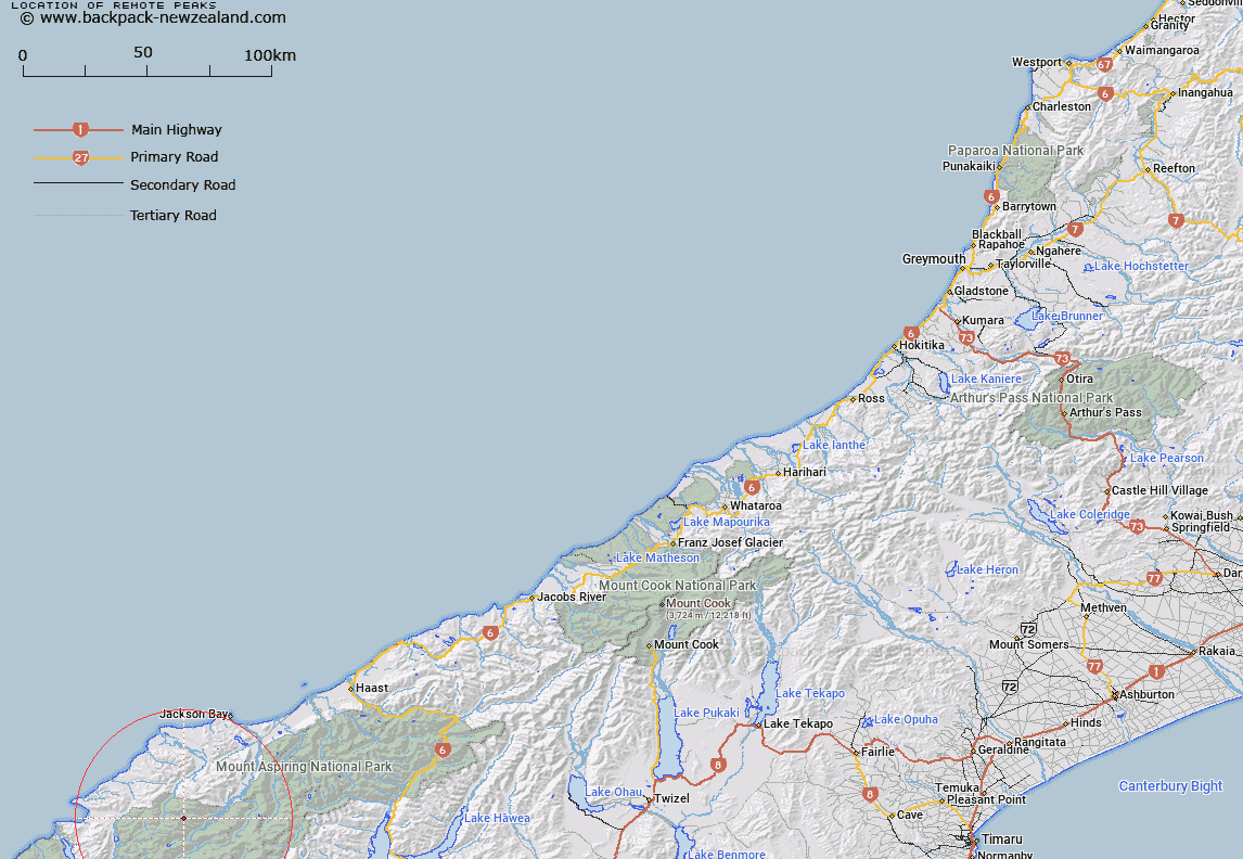
Map showing location of Remote Peaks


LINZ description: Twin summits due north of Halfway Saddle, at the head of an unnamed glacier.
Latitude: -44.319991
Longitude: 168.447934
Northing: 5082500
Easting: 1237000
Land District: Westland
Feat Type: Hill


Scroll down to see a more detailed road map and below that a topographical map showing the location of Remote Peaks. The road map has been supplied by openstreetmap and the topographical map of Remote Peaks has been supplied by Land Information New Zealand (LINZ).

Yes you can use the top static map for you school/university project or personal website with a link back. Contact me for any commercial use.

Remote Peaks Map New Zealand


New Zealand places in our database
[ A ] [ B ] [ C ] [ D ] [ E ] [ F ] [ G ] [ H ] [ I ] [ J ] [ K ] [ L ] [ M ] [ N ] [ O ] [ P ] [ Q ] [ R ] [ S ] [ T ] [ U ] [ V ] [ W ] [ X ] [ Y ] [ Z ]


Closest 20 Hills to Remote Peaks

Redoubt Peaks ( 1.8km )   Alfred Peak ( 3.27km )   Retreat Peaks ( 3.27km )   Toreador Peak ( 5.5km )   Joe Peak ( 5.88km )   Matador ( 5.99km )   Typhoon Peak ( 6.12km )   Tempest Peak ( 6.4km )   Picador ( 6.68km )   Holloway Peak ( 6.93km )   Mount Temple ( 7.31km )   Trinity ( 8.06km )   Red Mountain ( 8.19km )   Cilicia Peak ( 8.66km )   Bald Mountain ( 8.7km )   Farrell Peak ( 8.76km )   Mount Caria ( 8.85km )   Mount Raddle ( 9.33km )   Five Fingers ( 9.83km )   Camp Oven Dome ( 10.01km )   Gyrae ( 10.27km )   Turks Head ( 10.67km )   Pyramid ( 11.1km )   Darkness Peak ( 11.42km )   Telescope Hill ( 11.72km )   Richards Mountain ( 11.75km )   Mount Richards ( 11.75km )   Futurity Rock ( 11.87km )   Tararua Peak ( 11.88km )   Riddle Peak ( 12.11km )   Elespie ( 12.16km )   Mount Ionia ( 12.19km )   Gable Peak ( 12.34km )   Pic d'argent ( 12.38km )   Buttress ( 12.5km )   Little Ark ( 12.53km )   Eros ( 12.68km )   Beacon ( 12.86km )   Ark ( 12.99km )   The Tower ( 13.4km )