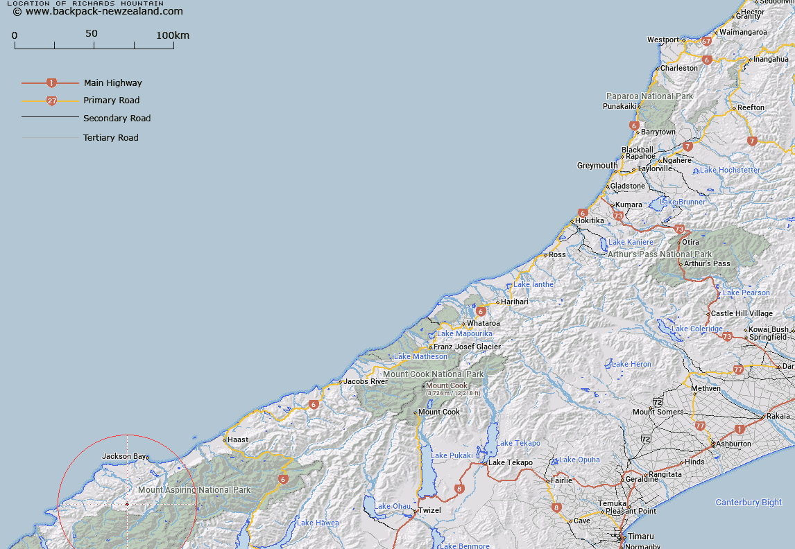
Map showing location of Richards Mountain


LINZ description: At 1454m height due north-west of Tararua Peak in the Olivine Range
Latitude: -44.222302
Longitude: 168.504307
Northing: 5093600
Easting: 1240900
Land District: Westland
Feat Type: Hill


Scroll down to see a more detailed road map and below that a topographical map showing the location of Richards Mountain. The road map has been supplied by openstreetmap and the topographical map of Richards Mountain has been supplied by Land Information New Zealand (LINZ).

Yes you can use the top static map for you school/university project or personal website with a link back. Contact me for any commercial use.

Richards Mountain Map New Zealand


New Zealand places in our database
[ A ] [ B ] [ C ] [ D ] [ E ] [ F ] [ G ] [ H ] [ I ] [ J ] [ K ] [ L ] [ M ] [ N ] [ O ] [ P ] [ Q ] [ R ] [ S ] [ T ] [ U ] [ V ] [ W ] [ X ] [ Y ] [ Z ]


Closest 20 Hills to Richards Mountain

Mount Richards ( 0.01km )   Riddle Peak ( 0.64km )   Tararua Peak ( 2.71km )   Mount Raddle ( 3.16km )   Bald Mountain ( 3.37km )   Staircase Mountain ( 5km )   Martyr Hill ( 5.24km )   Joe Peak ( 6.99km )   Mount Delta ( 9.03km )   Collyer ( 9.17km )   Distal ( 9.28km )   Mount Theta ( 9.52km )   Dagon ( 9.71km )   Alfred Peak ( 10.21km )   Remote Peaks ( 11.75km )   Mount Eggeling ( 11.92km )   Mount Eggelling ( 11.92km )   Redoubt Peaks ( 12.64km )   Charlies Bump ( 13.06km )   Junction Hill ( 13.62km )   Mount Lindsay ( 14.03km )   The Pommel ( 14.16km )   Baal ( 14.62km )   Snowden ( 14.71km )   Retreat Peaks ( 14.9km )   Dee Hill ( 15.07km )   Mount Nob ( 15.2km )   Mount Barry ( 15.84km )   Mount Bel ( 15.93km )   Mount Beta ( 16.14km )   Lucifer ( 16.42km )   Buncombe ( 16.58km )   Telescope Hill ( 16.63km )   Eros ( 16.71km )   Red Mountain ( 16.76km )   Tyler ( 16.78km )   Toreador Peak ( 17.2km )   Turks Head ( 17.26km )   Mount Caria ( 17.47km )   Matador ( 17.48km )