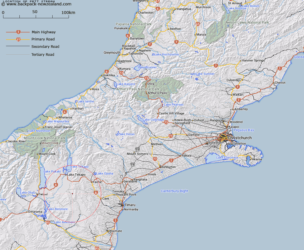
Map showing location of Fett Stream


LINZ description: Stream rising in the Dalgety Range, 800m South-west of Trig. Z (Geodetic Code AAPB), flowing North-westwards and joining Snow River 2.5km downstream of Hawkey Stream. Mackenzie Survey District.
Latitude: -44.248148
Longitude: 170.572641
Northing: 5097700
Easting: 1406200
Land District: Canterbury
Feat Type: Stream


Scroll down to see a more detailed road map and below that a topographical map showing the location of Fett Stream. The road map has been supplied by openstreetmap and the topographical map of Fett Stream has been supplied by Land Information New Zealand (LINZ).

Yes you can use the top static map for you school/university project or personal website with a link back. Contact me for any commercial use.

Fett Stream Map New Zealand


New Zealand places in our database
[ A ] [ B ] [ C ] [ D ] [ E ] [ F ] [ G ] [ H ] [ I ] [ J ] [ K ] [ L ] [ M ] [ N ] [ O ] [ P ] [ Q ] [ R ] [ S ] [ T ] [ U ] [ V ] [ W ] [ X ] [ Y ] [ Z ]


Closest 20 Streams to Fett Stream

Hankey Stream ( 2.93km )   Hawkey Stream ( 2.93km )   Hakataramea River ( 6.41km )   Snow River ( 6.46km )   Lockharts Stream ( 6.73km )   Dalgety Stream ( 7.99km )   Mackenzie River ( 8.03km )   Kennaway Stream ( 8.24km )   Exe Stream ( 9.71km )   Hayter Stream ( 10.52km )   Grays River ( 11.25km )   Avalanche Stream ( 11.39km )   Trap Stream ( 11.6km )   Massack Stream ( 12.2km )   Marsack Stream ( 12.2km )   Little Opawa River ( 12.79km )   Delamain Stream ( 14.19km )   Moffat Stream ( 14.24km )   Opawa River ( 14.54km )   Grampian Stream ( 14.78km )   Longden Stream ( 14.91km )   Duck Stream ( 15.06km )   Blainslie Stream ( 15.07km )   Nessing Stream ( 15.25km )   Balloon Stream ( 15.32km )   MacGregor Stream ( 15.55km )   Chamberlain Stream ( 15.96km )   Tramway Stream ( 16.21km )   Coal Stream ( 17.33km )   Two Legged Stream ( 18.05km )   Dunstan Stream ( 18.33km )   Blue Duck Stream ( 18.57km )   Bullock Creek ( 19.09km )   Paddys Market Stream ( 19.17km )   Paddy Market Stream ( 19.17km )   Greens Creek ( 19.17km )   Morton Stream ( 19.36km )   Halls Stream ( 20.28km )   Whiskey Cutting ( 20.96km )   Hay Stream ( 21.04km )