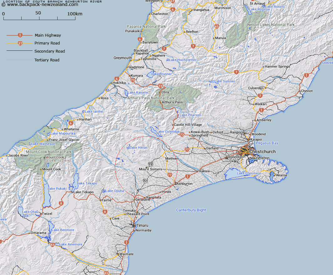
Map showing location of South Branch Ashburton River


LINZ description: Feature shown on: NZMS260-K37 075017; NZTopo50-BX20 706588;
Latitude: -43.71232
Longitude: 171.394932
Northing: 5158826.6
Easting: 1470694.2
Land District: Canterbury
Feat Type: Stream


Scroll down to see a more detailed road map and below that a topographical map showing the location of South Branch Ashburton River. The road map has been supplied by openstreetmap and the topographical map of South Branch Ashburton River has been supplied by Land Information New Zealand (LINZ).

Yes you can use the top static map for you school/university project or personal website with a link back. Contact me for any commercial use.

South Branch Ashburton River Map New Zealand


New Zealand places in our database
[ A ] [ B ] [ C ] [ D ] [ E ] [ F ] [ G ] [ H ] [ I ] [ J ] [ K ] [ L ] [ M ] [ N ] [ O ] [ P ] [ Q ] [ R ] [ S ] [ T ] [ U ] [ V ] [ W ] [ X ] [ Y ] [ Z ]


Closest 20 Streams to South Branch Ashburton River

Buccleugh Stream ( 2.32km )   Buccleuch Stream ( 2.6km )   Furze Stream ( 2.96km )   Hinds River North Branch ( 4.27km )   Caves Stream ( 5.31km )   Gawler Stream ( 5.4km )   Rangitata Diversion Race ( 5.53km )   Stevenson Stream ( 6.39km )   Stony Creek ( 6.61km )   Surrey Stream ( 7.28km )   Reid Stream ( 7.34km )   Ghost Stream ( 7.65km )   Limestone Creek ( 8.07km )   The Mill Creek ( 8.19km )   Flynn Stream ( 8.76km )   Tinstone Creek ( 9.27km )   Chapmans Creek ( 10.03km )   Woolshed Creek ( 10.28km )   Blondin Stream ( 10.75km )   Bowyers Stream ( 11.09km )   Broadleaf Stream ( 11.34km )   Staveley Stream ( 11.53km )   Pony Stream ( 12.08km )   Little Hinds Stream ( 12.37km )   Hinds River South Branch ( 12.48km )   Picnic Creek ( 12.49km )   Hinds River ( 12.51km )   Morgan Stream ( 13.66km )   Stour River ( 13.86km )   Hutt Creek ( 14.29km )   Rangitata River ( 14.49km )   Weta Stream ( 15.23km )   Diggers Creek ( 15.41km )   Chaffey Stream ( 15.46km )   Blue Duck Stream ( 15.56km )   Diamond Creek ( 15.59km )   O'Shea Creek ( 15.64km )   Sandrey Stream ( 16.09km )   Middlestream ( 16.56km )   Nabob Stream ( 16.59km )