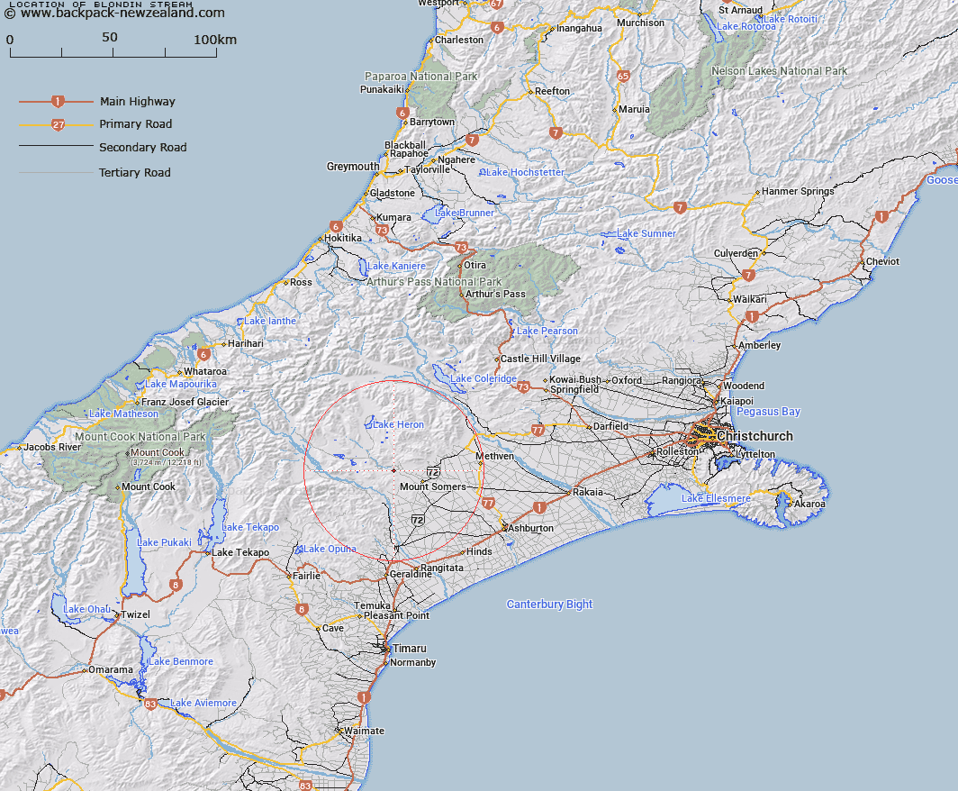
Map showing location of Blondin Stream


LINZ description: Stream flowing into the South Branch Ashburton River approximately 10km north-west of Mt Somers locality.
Latitude: -43.666843
Longitude: 171.27688
Northing: 5163686.5
Easting: 1461078.7
Land District: Canterbury
Feat Type: Stream


Scroll down to see a more detailed road map and below that a topographical map showing the location of Blondin Stream. The road map has been supplied by openstreetmap and the topographical map of Blondin Stream has been supplied by Land Information New Zealand (LINZ).

Yes you can use the top static map for you school/university project or personal website with a link back. Contact me for any commercial use.

Blondin Stream Map New Zealand


New Zealand places in our database
[ A ] [ B ] [ C ] [ D ] [ E ] [ F ] [ G ] [ H ] [ I ] [ J ] [ K ] [ L ] [ M ] [ N ] [ O ] [ P ] [ Q ] [ R ] [ S ] [ T ] [ U ] [ V ] [ W ] [ X ] [ Y ] [ Z ]


Closest 20 Streams to Blondin Stream

Woolshed Creek ( 3.46km )   Little Hinds Stream ( 4.36km )   Chapmans Creek ( 4.43km )   Stour River ( 5.19km )   Stony Creek ( 5.21km )   Blue Duck Stream ( 5.24km )   Ghost Stream ( 5.53km )   Sandrey Stream ( 5.59km )   Chaffey Stream ( 5.93km )   Limestone Creek ( 6.35km )   Waterfall Stream ( 7.01km )   Hinds River North Branch ( 7.12km )   Hinds River South Branch ( 7.27km )   Gawler Stream ( 8.19km )   Broadleaf Stream ( 8.33km )   Weta Stream ( 8.49km )   Markhams Stream ( 8.87km )   Morgan Stream ( 9.31km )   Caves Stream ( 9.46km )   Stevenson Stream ( 9.7km )   Tinstone Creek ( 10.09km )   Lambies Stream ( 10.21km )   Potato Stream ( 10.23km )   Nabob Stream ( 10.27km )   Reid Stream ( 10.39km )   Orr Stream ( 10.42km )   South Branch Ashburton River ( 10.75km )   South Branch Ashburton River/Hakatere ( 10.75km )   Buccleugh Stream ( 10.88km )   Moorhouse Stream ( 10.92km )   Furze Stream ( 11.08km )   Bowyers Stream ( 11.37km )   Buccleuch Stream ( 11.65km )   Stour River East Branch ( 11.67km )   Haast Stream ( 11.8km )   Stour River West Branch ( 12.09km )   Surrey Stream ( 12.28km )   Black Stream ( 12.42km )   Emma Stream ( 12.49km )   Pony Stream ( 12.63km )