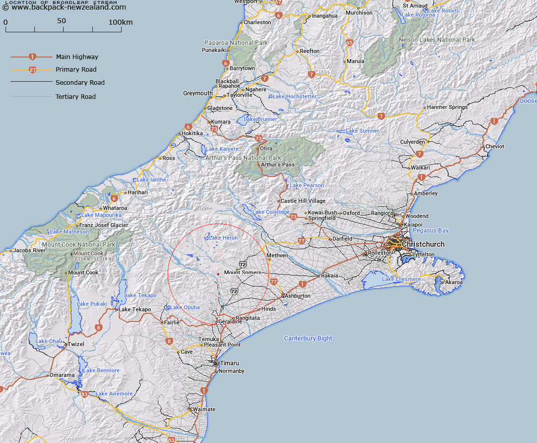
Map showing location of Broadleaf Stream


LINZ description: Flows south from the Peter Range and joins the Hinds River South Branch
Latitude: -43.740686
Longitude: 171.259406
Northing: 5155455.8
Easting: 1459842
Land District: Canterbury
Feat Type: Stream


Scroll down to see a more detailed road map and below that a topographical map showing the location of Broadleaf Stream. The road map has been supplied by openstreetmap and the topographical map of Broadleaf Stream has been supplied by Land Information New Zealand (LINZ).

Yes you can use the top static map for you school/university project or personal website with a link back. Contact me for any commercial use.

Broadleaf Stream Map New Zealand


New Zealand places in our database
[ A ] [ B ] [ C ] [ D ] [ E ] [ F ] [ G ] [ H ] [ I ] [ J ] [ K ] [ L ] [ M ] [ N ] [ O ] [ P ] [ Q ] [ R ] [ S ] [ T ] [ U ] [ V ] [ W ] [ X ] [ Y ] [ Z ]


Closest 20 Streams to Broadleaf Stream

Hinds River South Branch ( 2.14km )   Limestone Creek ( 3.54km )   Little Hinds Stream ( 5.03km )   Rangitata River ( 5.38km )   Nabob Stream ( 5.54km )   Gawler Stream ( 5.96km )   Boundary Stream ( 6.77km )   Middlestream ( 7.16km )   Surrey Stream ( 7.33km )   Hinds River North Branch ( 7.44km )   Chaffey Stream ( 7.64km )   Blondin Stream ( 8.33km )   Coal Creek ( 9.14km )   Rangitata Diversion Race ( 9.43km )   Middle Stream ( 9.57km )   Sandrey Stream ( 9.77km )   Chapmans Creek ( 9.78km )   Moorhouse Stream ( 10.3km )   Stony Creek ( 10.53km )   Soup Stream ( 11.25km )   Woolshed Creek ( 11.33km )   South Branch Ashburton River ( 11.34km )   South Branch Ashburton River/Hakatere ( 11.34km )   Ghost Stream ( 11.73km )   Chapmans Creek ( 12.08km )   Parson Stream ( 12.38km )   Blue Duck Stream ( 12.68km )   Lynn Stream ( 12.8km )   Buccleugh Stream ( 12.98km )   Waterfall Stream ( 13.3km )   Pudding Valley Creek ( 13.4km )   Saddle Hut Stream ( 13.49km )   Stour River ( 13.49km )   Furze Stream ( 13.52km )   Buccleuch Stream ( 13.61km )   Caves Stream ( 13.77km )   Little Peel Stream ( 14.32km )   Stevenson Stream ( 14.57km )   Mount Peel Creek ( 15.46km )   Reid Stream ( 15.58km )