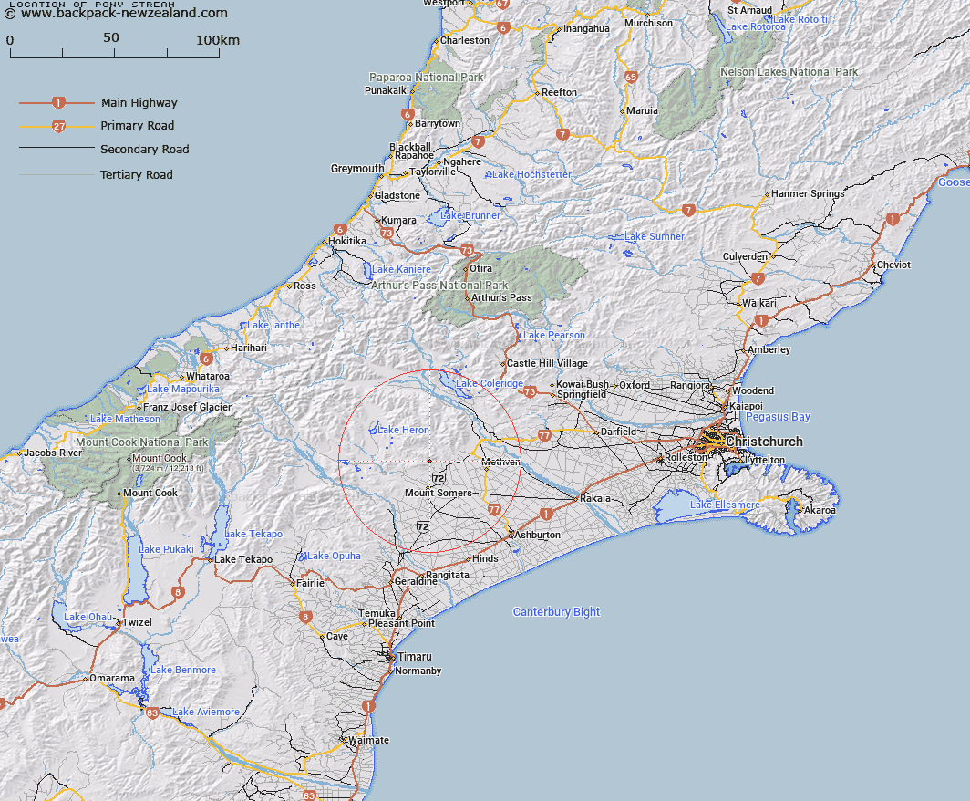
Map showing location of Pony Stream


LINZ description: Left bank tributary of Bowyers Stream rising 1.75km South South-east of Mount Winterslow [Trig. M (Geodetic Code ANEC)],in the Winterslow Range, flowing southward, and joining Bowyers Stream 1.8km South-east of Pony Knob. Blocks III and VII Alford Survey District
Latitude: -43.60405
Longitude: 171.407589
Northing: 5170871.1
Easting: 1471483
Land District: Canterbury
Feat Type: Stream


Scroll down to see a more detailed road map and below that a topographical map showing the location of Pony Stream. The road map has been supplied by openstreetmap and the topographical map of Pony Stream has been supplied by Land Information New Zealand (LINZ).

Yes you can use the top static map for you school/university project or personal website with a link back. Contact me for any commercial use.

Pony Stream Map New Zealand


New Zealand places in our database
[ A ] [ B ] [ C ] [ D ] [ E ] [ F ] [ G ] [ H ] [ I ] [ J ] [ K ] [ L ] [ M ] [ N ] [ O ] [ P ] [ Q ] [ R ] [ S ] [ T ] [ U ] [ V ] [ W ] [ X ] [ Y ] [ Z ]


Closest 20 Streams to Pony Stream

Bowyers Stream ( 1.3km )   Picnic Creek ( 1.93km )   Staveley Stream ( 2.51km )   Hutt Creek ( 2.74km )   Tinstone Creek ( 3.08km )   Diggers Creek ( 3.34km )   Flynn Stream ( 4.18km )   Diamond Creek ( 4.62km )   Reid Stream ( 4.74km )   Morgan Stream ( 5.58km )   The Mill Creek ( 5.64km )   Stevenson Stream ( 5.72km )   Grahams Creek ( 6.4km )   Caves Stream ( 6.81km )   Isaac Stream ( 7.4km )   Ghost Stream ( 7.62km )   Five Mile Creek ( 8.11km )   Saddle Creek ( 8.14km )   Ribbonwood Stream ( 8.19km )   Campbells Stream ( 8.2km )   Chapmans Creek ( 8.25km )   Weta Stream ( 8.55km )   Stony Creek ( 8.78km )   Waterfall Creek ( 9.24km )   Woolshed Creek ( 9.25km )   Furze Stream ( 9.39km )   Orr Stream ( 9.44km )   Buccleugh Stream ( 9.93km )   Buccleuch Stream ( 10.13km )   Stour River ( 10.52km )   Taylors Stream ( 10.92km )   Black Stream ( 11.68km )   Stour River East Branch ( 11.88km )   Boundary Creek ( 11.93km )   South Branch Ashburton River/Hakatere ( 12.08km )   South Branch Ashburton River ( 12.08km )   McLennan Creek ( 12.42km )   Blondin Stream ( 12.63km )   Hinds River North Branch ( 12.95km )   Stour River West Branch ( 13.26km )