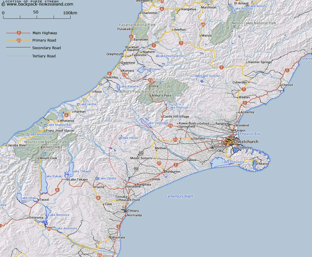
Map showing location of Furze Stream


LINZ description: Left bank tributary of Buccleuch Stream 3km in length, flowing westward and joining Buccleuch Stream North-west of Moray Farms Homestead. Block XI, Alford Survey District.
Latitude: -43.688486
Longitude: 171.411305
Northing: 5161499.1
Easting: 1471962.5
Land District: Canterbury
Feat Type: Stream


Scroll down to see a more detailed road map and below that a topographical map showing the location of Furze Stream. The road map has been supplied by openstreetmap and the topographical map of Furze Stream has been supplied by Land Information New Zealand (LINZ).

Yes you can use the top static map for you school/university project or personal website with a link back. Contact me for any commercial use.

Furze Stream Map New Zealand


New Zealand places in our database
[ A ] [ B ] [ C ] [ D ] [ E ] [ F ] [ G ] [ H ] [ I ] [ J ] [ K ] [ L ] [ M ] [ N ] [ O ] [ P ] [ Q ] [ R ] [ S ] [ T ] [ U ] [ V ] [ W ] [ X ] [ Y ] [ Z ]


Closest 20 Streams to Furze Stream

Buccleugh Stream ( 0.64km )   Buccleuch Stream ( 0.82km )   South Branch Ashburton River/Hakatere ( 2.96km )   South Branch Ashburton River ( 2.96km )   Caves Stream ( 2.99km )   Stevenson Stream ( 3.93km )   Reid Stream ( 4.71km )   The Mill Creek ( 5.23km )   Flynn Stream ( 5.84km )   Hinds River North Branch ( 6.08km )   Stony Creek ( 6.09km )   Ghost Stream ( 6.64km )   Tinstone Creek ( 6.82km )   Gawler Stream ( 7.81km )   Rangitata Diversion Race ( 8.47km )   Bowyers Stream ( 8.52km )   Staveley Stream ( 8.62km )   Chapmans Creek ( 9.14km )   Pony Stream ( 9.39km )   Picnic Creek ( 9.63km )   Woolshed Creek ( 9.66km )   Limestone Creek ( 10.05km )   Surrey Stream ( 10.22km )   Blondin Stream ( 11.08km )   Hutt Creek ( 11.45km )   Morgan Stream ( 11.78km )   Diamond Creek ( 12.67km )   Diggers Creek ( 12.74km )   Stour River ( 13.09km )   Broadleaf Stream ( 13.52km )   Little Hinds Stream ( 13.61km )   Weta Stream ( 13.78km )   Hinds River South Branch ( 14.34km )   Hinds River ( 14.81km )   Blue Duck Stream ( 15.28km )   Grahams Creek ( 15.46km )   O'Shea Creek ( 15.48km )   Orr Stream ( 15.64km )   Saddle Creek ( 16.11km )   Five Mile Creek ( 16.12km )