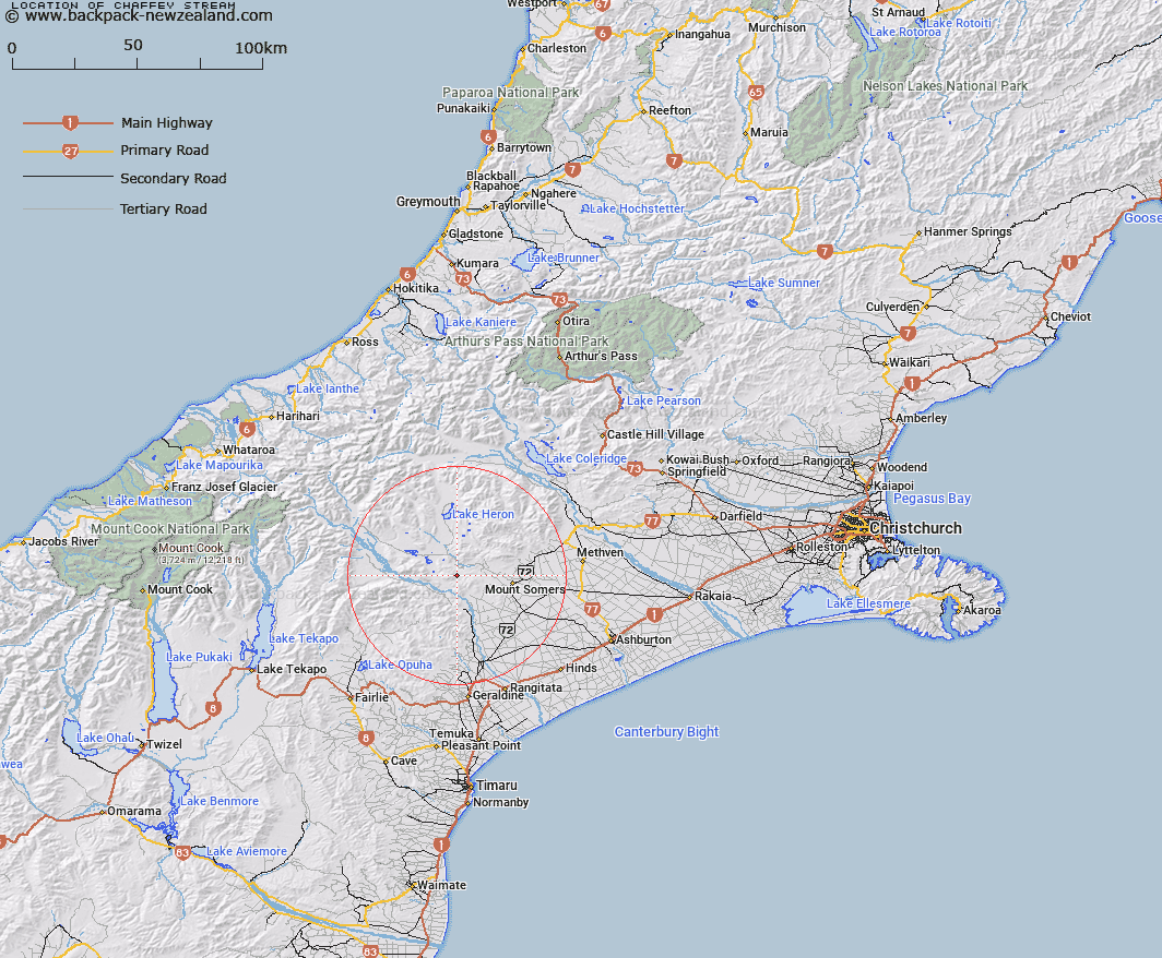
Map showing location of Chaffey Stream


LINZ description: Right bank tributary of Sandrey Stream rising on the North-east slopes of Mount Tripp [Trig. K (Geodetic Code ANF7)], flowing North-eastward and joining Sandrey Stream 2.3km West by South-west of Mount Possession Homestead. Block XII Tripp Survey District
Latitude: -43.683491
Longitude: 171.206835
Northing: 5161717.9
Easting: 1455471.5
Land District: Canterbury
Feat Type: Stream


Scroll down to see a more detailed road map and below that a topographical map showing the location of Chaffey Stream. The road map has been supplied by openstreetmap and the topographical map of Chaffey Stream has been supplied by Land Information New Zealand (LINZ).

Yes you can use the top static map for you school/university project or personal website with a link back. Contact me for any commercial use.

Chaffey Stream Map New Zealand


New Zealand places in our database
[ A ] [ B ] [ C ] [ D ] [ E ] [ F ] [ G ] [ H ] [ I ] [ J ] [ K ] [ L ] [ M ] [ N ] [ O ] [ P ] [ Q ] [ R ] [ S ] [ T ] [ U ] [ V ] [ W ] [ X ] [ Y ] [ Z ]


Closest 20 Streams to Chaffey Stream

Sandrey Stream ( 2.49km )   Little Hinds Stream ( 3.24km )   Moorhouse Stream ( 4.99km )   Hinds River South Branch ( 5.54km )   Nabob Stream ( 5.89km )   Blondin Stream ( 5.93km )   Waterfall Stream ( 6.33km )   Blue Duck Stream ( 6.82km )   Pudding Valley Creek ( 7.41km )   Broadleaf Stream ( 7.64km )   Lambies Stream ( 8.1km )   Coal Creek ( 8.27km )   Limestone Creek ( 8.34km )   Emma Stream ( 8.5km )   Potato Stream ( 9.11km )   Stour River ( 9.12km )   Woolshed Creek ( 9.16km )   Middle Stream ( 9.3km )   Denny Stream ( 9.95km )   Chapmans Creek ( 10.17km )   Markhams Stream ( 10.28km )   Soup Stream ( 10.3km )   Boundary Stream ( 10.59km )   Stony Creek ( 11km )   Gawler Stream ( 11.24km )   Hinds River North Branch ( 11.26km )   Haast Stream ( 11.34km )   Ghost Stream ( 11.45km )   Rangitata River ( 12.14km )   Weta Stream ( 12.69km )   Matagouri Stream ( 12.75km )   Middlestream ( 13.24km )   Quartz Creek ( 13.99km )   Orr Stream ( 14.17km )   Jacobs Stream ( 14.22km )   Paddle Hill Creek ( 14.33km )   Surrey Stream ( 14.33km )   Stour River West Branch ( 14.35km )   Morgan Stream ( 14.4km )   Balmacaan Stream ( 14.41km )