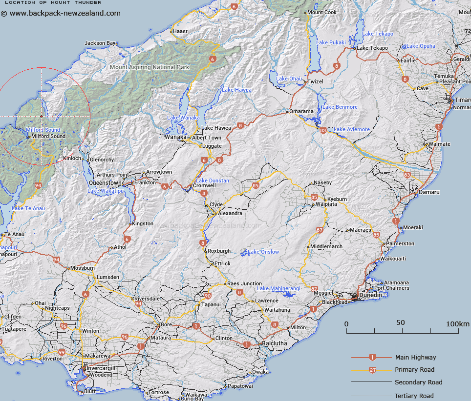
Map showing location of Mount Thunder


LINZ description: Peak to west of southern end of Lake McKerrow, between lake and Kaipo River.
Latitude: -44.516701
Longitude: 168.022586
Northing: 5058673.2
Easting: 1204411
Land District: Otago
Feat Type: Hill


Scroll down to see a more detailed road map and below that a topographical map showing the location of Mount Thunder. The road map has been supplied by openstreetmap and the topographical map of Mount Thunder has been supplied by Land Information New Zealand (LINZ).

Yes you can use the top static map for you school/university project or personal website with a link back. Contact me for any commercial use.

Mount Thunder Map New Zealand


New Zealand places in our database
[ A ] [ B ] [ C ] [ D ] [ E ] [ F ] [ G ] [ H ] [ I ] [ J ] [ K ] [ L ] [ M ] [ N ] [ O ] [ P ] [ Q ] [ R ] [ S ] [ T ] [ U ] [ V ] [ W ] [ X ] [ Y ] [ Z ]


Closest 20 Hills to Mount Thunder

Mount Thunder ( 0km )   Puketuroto Peak ( 3.28km )   Ongaruanuku ( 4.97km )   Halfway Peak ( 5.02km )   Parariki Peak ( 5.66km )   Mount Dot ( 5.91km )   Troglodyte ( 6km )   Paranui Peak ( 6.99km )   Alice Peak ( 7.58km )   Mount Tutoko ( 8.69km )   Te Hau ( 9.02km )   Mount Richardson ( 9.06km )   Grave Mountain ( 10.03km )   Mitis Peak ( 10.14km )   Mount Sutherland ( 10.15km )   Mount Terres ( 10.38km )   Mount Barton ( 10.57km )   Mount Madeline ( 10.99km )   Mount Webb ( 11.1km )   Mount McGulsh ( 11.11km )   Mount Pembroke ( 12.26km )   Mount Syme ( 12.29km )   Mount Milne ( 12.61km )   Benton Peak ( 12.7km )   Mount Tarewai ( 12.91km )   Mills Peak ( 12.98km )   Mount Mahere ( 13.14km )   Little Matterhorn ( 13.71km )   Courtenay Peak ( 13.74km )   Barrington Peak ( 13.97km )   Welshman Peak ( 14km )   Frenchman Peak ( 14.08km )   Hupokeka ( 14.1km )   Waitiri ( 14.11km )   Prospector Peak ( 14.8km )   The Lion ( 15.08km )   The Elephant ( 15.29km )   Rover Peak ( 15.36km )   Te Wera Peak ( 15.95km )   Fiery Peak ( 16.16km )