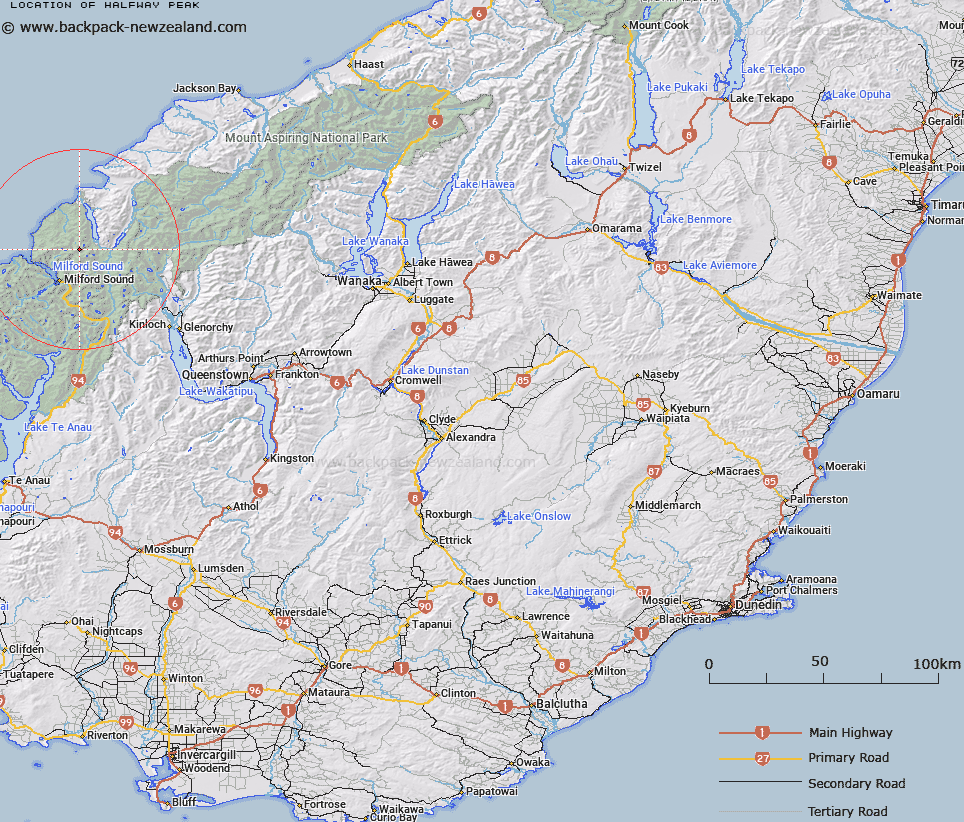
Map showing location of Halfway Peak


LINZ description: Peak halfway between Paranui and Puketuroto Peaks, south west of Lake McKerrow/Whakatipu Waitai.
Latitude: -44.559741
Longitude: 168.00366
Northing: 5053800
Easting: 1203200
Land District: Otago
Feat Type: Hill


Scroll down to see a more detailed road map and below that a topographical map showing the location of Halfway Peak. The road map has been supplied by openstreetmap and the topographical map of Halfway Peak has been supplied by Land Information New Zealand (LINZ).

Yes you can use the top static map for you school/university project or personal website with a link back. Contact me for any commercial use.

Halfway Peak Map New Zealand


New Zealand places in our database
[ A ] [ B ] [ C ] [ D ] [ E ] [ F ] [ G ] [ H ] [ I ] [ J ] [ K ] [ L ] [ M ] [ N ] [ O ] [ P ] [ Q ] [ R ] [ S ] [ T ] [ U ] [ V ] [ W ] [ X ] [ Y ] [ Z ]


Closest 20 Hills to Halfway Peak

Parariki Peak ( 0.8km )   Troglodyte ( 1.8km )   Paranui Peak ( 2.34km )   Puketuroto Peak ( 2.83km )   Ongaruanuku ( 3.17km )   Alice Peak ( 3.89km )   Mount Dot ( 3.9km )   Mount Tutoko ( 3.93km )   Mount Thunder ( 5.02km )   Grave Mountain ( 5.38km )   Mitis Peak ( 5.78km )   Te Hau ( 6.88km )   Mount Madeline ( 6.91km )   Mount Syme ( 7.81km )   Mount Milne ( 8.04km )   Benton Peak ( 8.13km )   Mount Tarewai ( 8.3km )   Mills Peak ( 8.34km )   Mount Mahere ( 8.48km )   Mount Pembroke ( 9.39km )   Waitiri ( 9.44km )   Little Matterhorn ( 10.28km )   Hupokeka ( 10.47km )   Mount Richardson ( 10.78km )   The Lion ( 10.98km )   Mount Barton ( 11.36km )   Te Wera Peak ( 11.68km )   The Elephant ( 11.89km )   Barren Peak ( 12.05km )   Rover Peak ( 12.14km )   Patuki Mountain ( 12.29km )   Mount Terres ( 12.53km )   Mount Underwood ( 12.63km )   Mount Sutherland ( 12.75km )   Karetai Peak ( 12.95km )   Bowen Hill ( 12.96km )   Prospector Peak ( 13.48km )   Footstool ( 13.89km )   Mount McGulsh ( 13.96km )   Mount Revelation ( 13.99km )