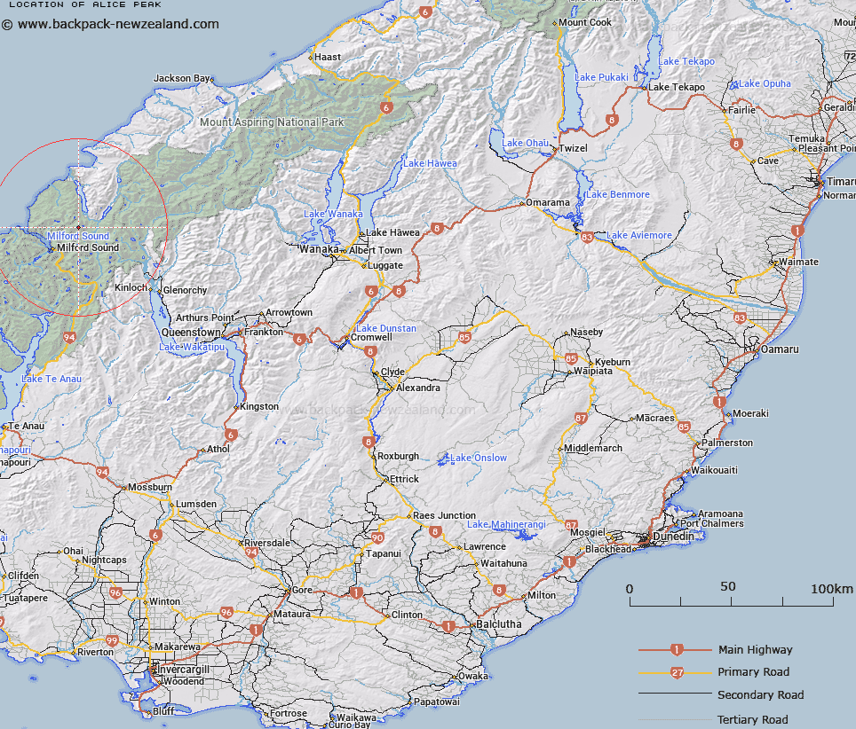
Map showing location of Alice Peak


LINZ description: 2155m peak between Glacier Creek and Stickup Creek near Mount Tutuko at the head of the Darren Ranges.
Latitude: -44.583807
Longitude: 168.039383
Northing: 5051300
Easting: 1206200
Land District: Otago
Feat Type: Hill


Scroll down to see a more detailed road map and below that a topographical map showing the location of Alice Peak. The road map has been supplied by openstreetmap and the topographical map of Alice Peak has been supplied by Land Information New Zealand (LINZ).

Yes you can use the top static map for you school/university project or personal website with a link back. Contact me for any commercial use.

Alice Peak Map New Zealand


New Zealand places in our database
[ A ] [ B ] [ C ] [ D ] [ E ] [ F ] [ G ] [ H ] [ I ] [ J ] [ K ] [ L ] [ M ] [ N ] [ O ] [ P ] [ Q ] [ R ] [ S ] [ T ] [ U ] [ V ] [ W ] [ X ] [ Y ] [ Z ]


Closest 20 Hills to Alice Peak

Mount Dot ( 2.28km )   Mount Tutoko ( 2.44km )   Mount Madeline ( 3.42km )   Halfway Peak ( 3.89km )   Parariki Peak ( 4.14km )   Puketuroto Peak ( 4.31km )   Mount Syme ( 4.84km )   Paranui Peak ( 4.99km )   Troglodyte ( 5.22km )   Mount Milne ( 5.23km )   Mount Tarewai ( 5.57km )   Mount Mahere ( 5.84km )   Waitiri ( 6.78km )   Grave Mountain ( 6.88km )   Ongaruanuku ( 7.05km )   Mount Thunder ( 7.58km )   Mitis Peak ( 7.73km )   Te Wera Peak ( 8.38km )   Benton Peak ( 9.31km )   Mills Peak ( 9.34km )   Patuki Mountain ( 9.62km )   Karetai Peak ( 9.85km )   Prospector Peak ( 9.94km )   Mount Underwood ( 10.35km )   Te Hau ( 10.36km )   Taiaroa Peak ( 10.87km )   Mount Revelation ( 10.88km )   Barren Peak ( 11.12km )   Tuhawaiki Mountain ( 11.56km )   Frenchman Peak ( 11.58km )   Apirana Peak ( 12.23km )   Mount Pembroke ( 12.31km )   Bowen Hill ( 12.33km )   Barrington Peak ( 12.38km )   The Lion ( 12.63km )   Hupokeka ( 12.68km )   Little Matterhorn ( 12.7km )   Welshman Peak ( 13.21km )   Mihj Peak ( 13.74km )   Courtenay Peak ( 13.74km )